
IMAGES TAKEN NEAR TO
Rhydwyn, HOLYHEAD, LL65 4EY
Introduction
This page details the photographs taken nearby to LL65 4EY by members of the Geograph project.
The Geograph project started in 2005 with the aim of publishing, organising and preserving representative images for every square kilometre of Great Britain, Ireland and the Isle of Man.

There are currently over 7.5m images from over14,400 individuals and you can help contribute to the project by visiting https://www.geograph.org.uk
Image Map
Images are licensed for reuse under creativecommons.org/licenses/by-sa/2.0
Notes
- Clicking on the map will re-center to the selected point.
- The higher the marker number, the further away the image location is from the centre of the postcode.
Image Listing (21 Images Found)
Images are licensed for reuse under creativecommons.org/licenses/by-sa/2.0
Image
Details
Distance
1

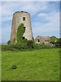
The hamlet around Melin Drylliau, Porth Swtan
Image: © Eric Jones
Taken: 26 Jun 2009
0.02 miles
3

Melin Drylliau Mill, Porth Swtan
Melin Drylliau is also known as Melin Caerau. The mill closed following a fire in 1914. In the 19thC, it was the scene of a tragic accident when a four years old girl was killed by the moving sails.
Image: © Eric Jones
Taken: 26 Jun 2009
0.05 miles
4

Ruined windmill inland of the coastal path
The tower of this old windmill stands out inland of the path.
Image: © Jeremy Bolwell
Taken: 10 Apr 2011
0.06 miles
5

View north towards the ruined Melin Drylliau mill
Image: © Eric Jones
Taken: 4 Jul 2009
0.07 miles
6
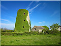
Melin Drylliau Mill
Melin Drylliau Mill near Church Bay acted as a landmark for sailors due to its proximity to the coast.
Source: https://www.anglesey-history.co.uk
Image: © Jeff Buck
Taken: 15 May 2019
0.07 miles
7

Melin Drylliau Mill
Melin Drylliau Mill near Church Bay acted as a landmark for sailors due to its proximity to the coast.
Source: https://www.anglesey-history.co.uk
Image: © Jeff Buck
Taken: 15 May 2019
0.07 miles
8

Melin Drylliau
A windmill destroyed by fire in 1914.
Image: © Chris Andrews
Taken: 24 Jul 2019
0.07 miles
9

Footpath from Ty-Colbi
Public footpath heading south from Ty-Colbi near the ruins of Melin Drylliau mill.
Image: © Jeff Buck
Taken: 15 May 2019
0.11 miles
10

The mill lane near its junction with the coastal road
The thatched Bwthyn Swtan cottage can be seen in the background.
Image: © Eric Jones
Taken: 26 Jun 2009
0.11 miles