
IMAGES TAKEN NEAR TO
Maes Yr Ysgol, LL65 4AX
Introduction
This page details the photographs taken nearby to Maes Yr Ysgol, LL65 4AX by members of the Geograph project.
The Geograph project started in 2005 with the aim of publishing, organising and preserving representative images for every square kilometre of Great Britain, Ireland and the Isle of Man.

There are currently over 7.5m images from over14,400 individuals and you can help contribute to the project by visiting https://www.geograph.org.uk
Image Map
Images are licensed for reuse under creativecommons.org/licenses/by-sa/2.0
Notes
- Clicking on the map will re-center to the selected point.
- The higher the marker number, the further away the image location is from the centre of the postcode.
Image Listing (31 Images Found)
Images are licensed for reuse under creativecommons.org/licenses/by-sa/2.0
Image
Details
Distance
1
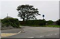
Access road to Ty Croes, Llanfachraeth
Image: © nick macneill
Taken: 23 Sep 2013
0.07 miles
2
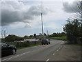
Bend in the A5025 near Llanfachraith/Llanfachraeth Church
Image: © Eric Jones
Taken: 3 May 2009
0.10 miles
3
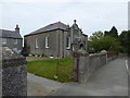
Capel Abarim, Llanfachraeth
Early C20 Methodist chapel, dated 1908 on the name plaque above entrance. It was built to replace the earlier chapel on the site which, according to a slate plaque above the side entrance was erected in 1860. It is a Grade II listed building and still in use as a chapel.
Image: © Eirian Evans
Taken: 18 Jun 2015
0.10 miles
4
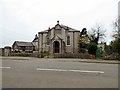
Abarim Methodist Chapel
The Grade II listed https://www.coflein.gov.uk/en/site/8733/details/abarim-chapel-welsh-calvinistic-methodist-llanfachraeth Abarim Methodist Chapel was built in 1862 in the Simple Round-Headed and Arts and Craft style of the short-wall entry type. The chapel was renovated in 1908.
Image: © Gerald England
Taken: 20 Mar 2019
0.10 miles
5
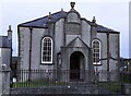
Abarim Chapel (Welsh Calvinistic Methodist)
Abarim Methodist Chapel was built in 1862 in the Simple Round-Headed and Arts and Craft style of the short-wall entry type. The chapel was renovated in 1908.
Image: © Arthur C Harris
Taken: 24 Apr 2021
0.11 miles
6
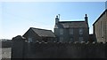
Ty Capel Abarim, Llanfachraith/Llanfachraeth
The Calvinist Capel Abarim stands in the centre of the village of Llanfachraith, with the chapel house on its south side. The present chapel and house date from the 1860s.
Image: © Eric Jones
Taken: 11 Apr 2009
0.12 miles
7
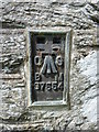
Flush bracket S7554 on St. Machraeth's Church, Llanfachraeth
This flush bracket located on St. Machreath's Church in Llanfachraeth is shown in the Ordnance Survey database as being 11.8446m above the Newlyn datum.
Image: © Meirion
Taken: 13 Jul 2010
0.12 miles
8
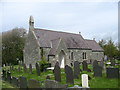
Eglwys Machraith Sant, Llanfachraith from the south-west
Image: © Eric Jones
Taken: 3 May 2009
0.12 miles
10
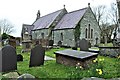
St Machraeth Church, Llanfachraeth
There has been a church here since the 7thC, but the present building is relatively modern, having been built in 1878.
A Church in Wales.
Image: © Richard Hoare
Taken: 20 Mar 2019
0.13 miles