
IMAGES TAKEN NEAR TO
Llanynghenedl, HOLYHEAD, LL65 3DG
Introduction
This page details the photographs taken nearby to LL65 3DG by members of the Geograph project.
The Geograph project started in 2005 with the aim of publishing, organising and preserving representative images for every square kilometre of Great Britain, Ireland and the Isle of Man.

There are currently over 7.5m images from over14,400 individuals and you can help contribute to the project by visiting https://www.geograph.org.uk
Image Map
Images are licensed for reuse under creativecommons.org/licenses/by-sa/2.0
Notes
- Clicking on the map will re-center to the selected point.
- The higher the marker number, the further away the image location is from the centre of the postcode.
Image Listing (17 Images Found)
Images are licensed for reuse under creativecommons.org/licenses/by-sa/2.0
Image
Details
Distance
1
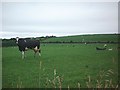
Dairy Herd
This image looking east from SH317813, shows some dairy cattle grazing on the pasture land. The farm buildings of Tyddyn-hirion can just be seen in the distance above the large cow on the left of the image.
Image: © Dave Smethurst
Taken: 15 Aug 2005
0.03 miles
2
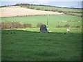
Llanynghenedl Standing Stone.
Also known as Shop Farm Standing Stone.
Image: © Ray West
Taken: 10 Oct 2008
0.07 miles
3
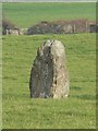
The Llanynghenedl Standing Stone, Anglesey.
A view of the Llanynghenedl Standing Stone, from the A5025.
Image: © Stephen Elwyn RODDICK
Taken: 23 Jan 2006
0.08 miles
4
Ploughed field on the side of a drumlin near Llanynghenedl
Image: © Eric Jones
Taken: 11 Apr 2009
0.12 miles
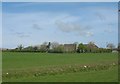
6

A5025 north at Llanynghenedl
From lay-by by phone box
Image: © John Firth
Taken: 3 Oct 2011
0.18 miles
7
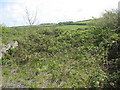
The interior of St Enghenedl Church
Although rebuilt in the 19thC, this small church increasingly ran out of congregants after the building of a new church in nearby Valley. It was decided to demolish the church in the 1980s.
Image: © Eric Jones
Taken: 3 May 2009
0.19 miles
8
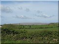
Polythene covered drumlin crop land at Llanfairynghenedl
Mr Stephen Roddick has photographed the same polythene-covered drumlin in earlier years.
Image: © Eric Jones
Taken: 3 May 2009
0.20 miles
9

Crops under Polythene at Llanynghenedl
A view of the reflected light on the polythene covered hillside at Llanynghenedl, Anglesey.
Image: © Stephen Elwyn RODDICK
Taken: 27 May 2008
0.21 miles
10
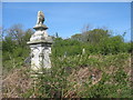
The slightly overgrown churchyard at Llanynghenedl
Image: © Eric Jones
Taken: 3 May 2009
0.21 miles