
IMAGES TAKEN NEAR TO
Llys Treseifion, HOLYHEAD, LL65 2QB
Introduction
This page details the photographs taken nearby to Llys Treseifion, LL65 2QB by members of the Geograph project.
The Geograph project started in 2005 with the aim of publishing, organising and preserving representative images for every square kilometre of Great Britain, Ireland and the Isle of Man.

There are currently over 7.5m images from over14,400 individuals and you can help contribute to the project by visiting https://www.geograph.org.uk
Image Map
Images are licensed for reuse under creativecommons.org/licenses/by-sa/2.0
Notes
- Clicking on the map will re-center to the selected point.
- The higher the marker number, the further away the image location is from the centre of the postcode.
Image Listing (28 Images Found)
Images are licensed for reuse under creativecommons.org/licenses/by-sa/2.0
Image
Details
Distance
3
Porthdafarch Road, Ynys Gybi/Holyhead, Holy Island
A long road which at this end is residential and consists of mainly terraced housing.
Image: © P L Chadwick
Taken: 20 Sep 2015
0.15 miles
4
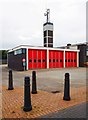
Holyhead Fire Station (1), Kingsland Road, Ynys Gybi/Holyhead, Holy Island
The fire station with drill tower behind. Operated by North Wales Fire and Rescue Service. The fire station relocated here in 1965. The former station in Cleveland Avenue, after change of use, was eventually demolished.
Image
Image: © P L Chadwick
Taken: 20 Sep 2015
0.16 miles
5
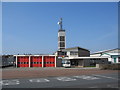
Holyhead Fire Station
A view looking to the west across the A5154 from the roundabout at the end of the A55 dual carriageway, towards the Fire Station at Holyhead.
Image: © Phil Williams
Taken: 8 Apr 2007
0.16 miles
6
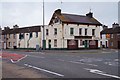
Foresters Arms (1), Mountain View, Ynys Gybi/Holyhead, Holy Island
This public house in the Kingsland area of the town has been closed since at least June 2013, according to the CAMRA site "Whatpub". There is a photo on Geograph, taken in August 2005, showing what it looked like when it was open. See:- Image
Image
Image: © P L Chadwick
Taken: 20 Sep 2015
0.17 miles
7
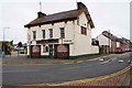
Foresters Arms (2), Mountain View, Ynys Gybi/Holyhead, Holy Island
This public house has been closed since at least June 2013.
Image
Image: © P L Chadwick
Taken: 20 Sep 2015
0.17 miles
8
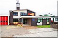
Holyhead Fire Station (2), Kingsland Road, Ynys Gybi/Holyhead, Holy Island
Opened in 1965 and operated by North Wales Fire and Rescue Service. It is a wholetime station.
Image
Image: © P L Chadwick
Taken: 20 Sep 2015
0.17 miles
9
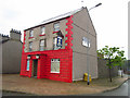
The Angel Holyhead
The Angel Inn,Kingsland,Holyhead,Anglesey
Image: © Arthur C Harris
Taken: 19 May 2014
0.17 miles
10
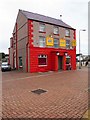
The Angel Chinese Takeaway, Kingsland Road, Ynys Gybi/Holyhead, Holy Island
This was for many years a pub called The Angel but now it is a Chinese takeaway, which also does fish and chips. There are a couple of photos on this site showing the building when it was a pub e.g. Image
Image: © P L Chadwick
Taken: 20 Sep 2015
0.17 miles