IMAGES TAKEN NEAR TO
Llainfain, HOLYHEAD, LL65 1NF
Introduction
This page details the photographs taken nearby to Llainfain, LL65 1NF by members of the Geograph project.
The Geograph project started in 2005 with the aim of publishing, organising and preserving representative images for every square kilometre of Great Britain, Ireland and the Isle of Man.

There are currently over 7.5m images from over14,400 individuals and you can help contribute to the project by visiting https://www.geograph.org.uk
Image Map
Images are licensed for reuse under creativecommons.org/licenses/by-sa/2.0
Notes
- Clicking on the map will re-center to the selected point.
- The higher the marker number, the further away the image location is from the centre of the postcode.
Image Listing (18 Images Found)
Images are licensed for reuse under creativecommons.org/licenses/by-sa/2.0
Image
Details
Distance
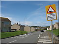
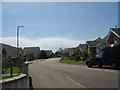
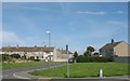
2
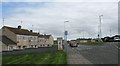
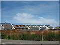
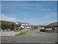
Waen Fawr Estate, Llaingoch
This is a local authority built estate.
Image: © Eric Jones
Taken: 13 Aug 2009
0.03 miles
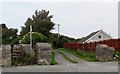
5
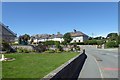
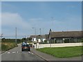
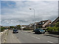
Tre Ambrose
Looking around a bend on Tre Ambrose leading across the island.
Image: © DS Pugh
Taken: 5 Aug 2018
0.07 miles