
IMAGES TAKEN NEAR TO
Armenia Street, HOLYHEAD, LL65 1DY
Introduction
This page details the photographs taken nearby to Armenia Street, LL65 1DY by members of the Geograph project.
The Geograph project started in 2005 with the aim of publishing, organising and preserving representative images for every square kilometre of Great Britain, Ireland and the Isle of Man.

There are currently over 7.5m images from over14,400 individuals and you can help contribute to the project by visiting https://www.geograph.org.uk
Image Map
Images are licensed for reuse under creativecommons.org/licenses/by-sa/2.0
Notes
- Clicking on the map will re-center to the selected point.
- The higher the marker number, the further away the image location is from the centre of the postcode.
Image Listing (289 Images Found)
Images are licensed for reuse under creativecommons.org/licenses/by-sa/2.0
Image
Details
Distance
1
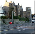
Rear of grade II listed Stanley House, Holyhead
Viewed across Victoria Road. Stanley House has four storeys on this side and three storeys on the front of the house, which faces Market Square. The early 19th century townhouse is built over the south wall of the Roman fort, Caer Gybi, and incorporates some of its fabric. The crenellated circular stone tower, a later addition to the house, was built near the supposed site of the fort's SE tower.
Stanley House was Grade II listed in September 1951.
Image: © Jaggery
Taken: 26 Mar 2012
0.03 miles
2
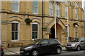
Holyhead Town Hall
There is a cut bench mark on the buttress to the left of the photograph and a closer view can be seen here: Image
Image: © Mark Anderson
Taken: 6 Sep 2011
0.05 miles
3
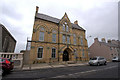
Neuadd Y Dref Caergybi / Holyhead Town Council
Image: © Arthur C Harris
Taken: 15 Sep 2013
0.05 miles
4
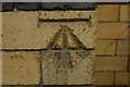
Cut Bench Mark, Holyhead Town Hall
Bench Mark Database: http://www.bench-marks.org.uk/bm23657
Image: © Mark Anderson
Taken: 6 Sep 2011
0.06 miles
5
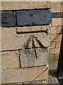
Benchmark on town hall, Holyhead
This benchmark is located on the SW face of the town hall on Newry Street in Holyhead and it is shown in the current Ordnance Survey database at a height of 13.6672m above the Newlyn datum.
Image: © Meirion
Taken: 14 Apr 2012
0.06 miles
7
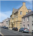
The Holyhead Town Hall and the English Baptist Chapel, Newry Street
Image: © Eric Jones
Taken: 24 Jul 2009
0.06 miles
8
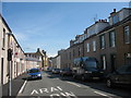
View East along Newry Street
The yellow brick Town Hall can be seen at the end of this stretch of road.
Image: © Eric Jones
Taken: 24 Jul 2009
0.06 miles
9
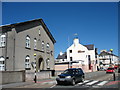
The former Bethel Welsh Wesleyan Chapel, Victoria Road
This former chapel is now converted into residential units. The Welsh and English Wesleyan causes however still meet in the vestry. The chapel was first built in 1808 and extended in 1866, 1901 and 1935. In 1941 it was badly damaged by the Luftwaffe, and was rebuilt in 1955.
www.bbc.co.uk/wales/northwest/sites/holyhead/pages/wartime2.shtml
Image: © Eric Jones
Taken: 8 Aug 2007
0.07 miles
10
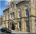
Neuadd y Dref/Town Hall, Newry Street, Holyhead
Image: © Eric Jones
Taken: 24 Jul 2009
0.07 miles