IMAGES TAKEN NEAR TO
Stanley Crescent, HOLYHEAD, LL65 1DE
Introduction
This page details the photographs taken nearby to Stanley Crescent, LL65 1DE by members of the Geograph project.
The Geograph project started in 2005 with the aim of publishing, organising and preserving representative images for every square kilometre of Great Britain, Ireland and the Isle of Man.

There are currently over 7.5m images from over14,400 individuals and you can help contribute to the project by visiting https://www.geograph.org.uk
Image Map
Images are licensed for reuse under creativecommons.org/licenses/by-sa/2.0
Notes
- Clicking on the map will re-center to the selected point.
- The higher the marker number, the further away the image location is from the centre of the postcode.
Image Listing (306 Images Found)
Images are licensed for reuse under creativecommons.org/licenses/by-sa/2.0
Image
Details
Distance
1
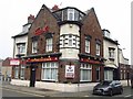
The South Stack in Holyhead
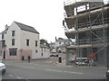
Closed public house along Victoria Road.
Image: © Mat Fascione
Taken: 17 Apr 2022
0.02 miles
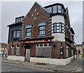
5
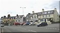
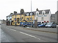
Marine Square near the entrance to Salt Island
The square which faces the Inner Harbour has a number of inns and hotels.
Image: © Eric Jones
Taken: 4 Jul 2008
0.04 miles
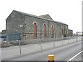
6
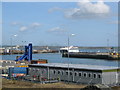
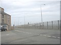
Holyhead Port
A view looking to the northeast from the churchyard of St. Cybi church, towards the port area. The Irish Ferries vessel, Jonathon Swift, is reversing from its berth on Salt Island as it starts its voyage to Dublin.
Image: © Phil Williams
Taken: 14 Apr 2006
0.04 miles
7
Here now endeth the A5
Today, the No Through Road sign marks the end of the 240 miles journey from Marble Arch, London. Before the new dock redevelopment, the A5 ended at the Admiralty Arch near the Customs House on Salt Island.
Image: © Eric Jones
Taken: 28 Jun 2008
0.04 miles
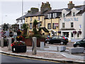
8
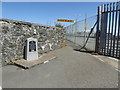
Memorial to Thomas Telford near the entrance to Salt Island
The memorial marks the end of Thomas Telford's road to Holyhead which was built between 1810 and 1826
Image: © Eirian Evans
Taken: 20 Jun 2015
0.06 miles