
IMAGES TAKEN NEAR TO
Stanley Terrace, HOLYHEAD, LL65 1BY
Introduction
This page details the photographs taken nearby to Stanley Terrace, LL65 1BY by members of the Geograph project.
The Geograph project started in 2005 with the aim of publishing, organising and preserving representative images for every square kilometre of Great Britain, Ireland and the Isle of Man.

There are currently over 7.5m images from over14,400 individuals and you can help contribute to the project by visiting https://www.geograph.org.uk
Image Map
Images are licensed for reuse under creativecommons.org/licenses/by-sa/2.0
Notes
- Clicking on the map will re-center to the selected point.
- The higher the marker number, the further away the image location is from the centre of the postcode.
Image Listing (404 Images Found)
Images are licensed for reuse under creativecommons.org/licenses/by-sa/2.0
Image
Details
Distance
1
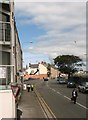
Victoria Road (A5) from the corner of Boston Street
Image: © Eric Jones
Taken: 14 Aug 2009
0.00 miles
2
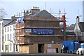
Holyhead Townscape Heritage Initiative
The Holyhead Townscape Heritage Initiative (THI) is a heritage regeneration programme which is part-funded by the Heritage Lottery Fund (HLF) across the UK. Anglesey County Council has secured £1m from the HLF towards a THI in Holyhead Town Centre, and has secured matching resources of some £2m to create a funding package totalling some £3m. The matching funds include contributions from ERDF, Welsh Assembly, Anglesey County Council, and Cadw.
Info. courtesy of http://www.caergybiymlaen.com/en-GB/Townscape-Heritage-Initiative
Image: © Arthur C Harris
Taken: 19 Mar 2014
0.02 miles
3
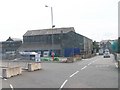
Nineteenth century built warehouses alongside the modern internal dock road
The internal dock road replaced railway tracks that served the port.
Image: © Eric Jones
Taken: 22 Aug 2009
0.03 miles
5
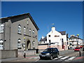
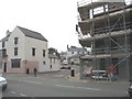
The former Bethel Welsh Wesleyan Chapel, Victoria Road
This former chapel is now converted into residential units. The Welsh and English Wesleyan causes however still meet in the vestry. The chapel was first built in 1808 and extended in 1866, 1901 and 1935. In 1941 it was badly damaged by the Luftwaffe, and was rebuilt in 1955.
www.bbc.co.uk/wales/northwest/sites/holyhead/pages/wartime2.shtml
Image: © Eric Jones
Taken: 8 Aug 2007
0.04 miles
6
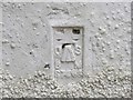
Ordnance Survey Flush Bracket S7558
This can be found on a former, now disused, Post Office building in Holyhead. The benchmark height is recorded as being 8.212 metres above sea level. For moe detail see : http://www.bench-marks.org.uk/bm16348
Image: © Peter Wood
Taken: 5 Dec 2017
0.04 miles
7
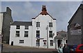
Post Office, Boston Street, Holyhead - 1
Next door, on the right, is a single storey extension, which is used by the public … see …
Image
Image
I have no idea who the two people are … but they stopped to pose when they saw me.
Image: © Terry Robinson
Taken: 28 May 2013
0.04 miles
8
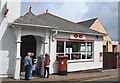
Post Office, Boston Street, Holyhead - 2
This extension to the main building is the 'shop and counter' area …
… the main building is (I believe) used for sorting mail and parcels
See also …
Image
Image
Image: © Terry Robinson
Taken: 28 May 2013
0.04 miles
9
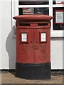
Post Box outside the Post Office, Boston Street, Holyhead
Presumably this 'twin slot' post box would have been for First and Second Class Mail …
… or maybe for 'local' Anglesey Mail and other Mail … or Sea and Land … do you know?
See also …
Image
Image
Image: © Terry Robinson
Taken: 28 May 2013
0.04 miles
10
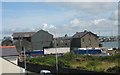
Old Warehouses in the Inner Harbour at Holyhead
Image: © Eric Jones
Taken: 24 Jul 2009
0.05 miles