IMAGES TAKEN NEAR TO
Sisial Y Mor, RHOSNEIGR, LL64 5XB
Introduction
This page details the photographs taken nearby to Sisial Y Mor, LL64 5XB by members of the Geograph project.
The Geograph project started in 2005 with the aim of publishing, organising and preserving representative images for every square kilometre of Great Britain, Ireland and the Isle of Man.

There are currently over 7.5m images from over14,400 individuals and you can help contribute to the project by visiting https://www.geograph.org.uk
Image Map
Images are licensed for reuse under creativecommons.org/licenses/by-sa/2.0
Notes
- Clicking on the map will re-center to the selected point.
- The higher the marker number, the further away the image location is from the centre of the postcode.
Image Listing (48 Images Found)
Images are licensed for reuse under creativecommons.org/licenses/by-sa/2.0
Image
Details
Distance
1
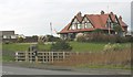
The elegant Cefn Dref villa overlooking Llyn Maelog.
Image: © Eric Jones
Taken: 14 Nov 2008
0.10 miles
2
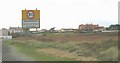
Cefn Dref villa seen from the SE approach into Rhosneigr
Cefn Dref (=back of the town) is an Edwardian villa built as a holiday home by an industrialist. Today it still functions as a holiday facility.
http://www.rhosneigr.net/housecd.htm
Image: © Eric Jones
Taken: 14 Nov 2008
0.11 miles
3
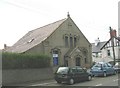
Capel Horeb - the home of the Rhosneigr Evangelical Church
This chapel was built by the Wesleyan Methodists in 1904 to seat 200 worshippers. A dwindling congregation led to its closure in 1986. It was then taken over by the Rhosneigr Evangelical Church.
http://www.horebchapel.org.uk/
Image: © Eric Jones
Taken: 14 Nov 2008
0.11 miles
4
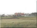
Cefn Dref
Cefn Dref means "back of the town".
Image: © Eric Jones
Taken: 14 Nov 2008
0.11 miles
5
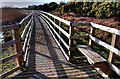
The Boardwalk
A view of the newly completed boardwalk which runs along the shore of the Maelog Lake.
Image: © Stephen Elwyn RODDICK
Taken: 23 Jan 2009
0.12 miles
8
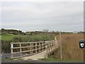
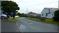
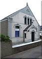
Bridge and walkway which form part of the Llyn Maelog circular walk
http://angleseywicklowwalks.com/index.php?option=com_content&view=article&id=60&Itemid=76&lang=en
Image: © Eric Jones
Taken: 14 Nov 2008
0.14 miles
9
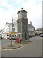
Sgwar Rhosneigr Square
The square is dominated by the war memorial clock. The paved area to the right of the clock is the village bus station. The village is served by the No 45 Rhosneigr-Llangefni service and No 25 Aberffraw-Holyhead service, each making the round trip five times daily Mon-Sat.
Image: © Eric Jones
Taken: 14 Nov 2008
0.14 miles