
IMAGES TAKEN NEAR TO
Aberffraw, TY CROES, LL63 5YR
Introduction
This page details the photographs taken nearby to LL63 5YR by members of the Geograph project.
The Geograph project started in 2005 with the aim of publishing, organising and preserving representative images for every square kilometre of Great Britain, Ireland and the Isle of Man.

There are currently over 7.5m images from over14,400 individuals and you can help contribute to the project by visiting https://www.geograph.org.uk
Image Map
Images are licensed for reuse under creativecommons.org/licenses/by-sa/2.0
Notes
- Clicking on the map will re-center to the selected point.
- The higher the marker number, the further away the image location is from the centre of the postcode.
Image Listing (87 Images Found)
Images are licensed for reuse under creativecommons.org/licenses/by-sa/2.0
Image
Details
Distance
1

Ty'n Twll, Aberffraw
Small cottage near the Anglesey Motor Racing Circuit
Image: © Eirian Evans
Taken: 30 Jul 2020
0.00 miles
2

North Wales WWII defences: Ty Croes Camp, Anglesey - Loopholed Wall (3)
-
Loopholed Wall: DoB ID: e41697
Image: © Mike Searle
Taken: 18 May 2017
0.02 miles
3

North Wales WWII defences: Ty Croes Camp, Anglesey - Loopholed Wall (2)
-
Loopholed Wall: DoB ID: e41697
Image
Image: © Mike Searle
Taken: 18 May 2017
0.02 miles
4

North Wales WWII defences: Ty Croes Camp, Anglesey - Loopholed Wall (1)
-
Loopholed Wall: DoB ID: e41697
Anti-Aircraft artillery ranges and their associated military infrastructure were established in 1941 at a remote headland accessed from the road between Aberffraw and Rhosneigr on the west coast of Anglesey. Due to continuous development lasting well into the early 1970s, and subsequent site clearance in the 1990s and 2000s, few remnants of the wartime infrastructure survives. This loopholed wall outside of the main site protected the approach from the beach at Porth Cwyfan. It's the only known defensive position from WWII at Ty Croes to have survived.
Image
Image: © Mike Searle
Taken: 18 May 2017
0.02 miles
5

Ty'n Twll Cottage with Eglwys St Cwyfan Church in the background
Image: © Eric Jones
Taken: 4 Nov 2008
0.02 miles
6
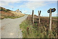
Redundant stile on the Anglesey Coastal Path
The Anglesey Coastal Path as it heads north from Porth Cwyfan. This part is a permissive path and the cottage is Ty'n-twll.
Image: © Jeff Buck
Taken: 24 Sep 2015
0.04 miles
7

View across cropland towards Ty'n Twll and Ty Cwyfan cottages
Image: © Eric Jones
Taken: 4 Nov 2008
0.05 miles
8

View down to the valley next to Ty Cwyfan
Image: © Eric Jones
Taken: 18 Aug 2008
0.05 miles

10

Ty Cwyfan set between coastal marshland and cropland
Image: © Eric Jones
Taken: 4 Nov 2008
0.07 miles