
IMAGES TAKEN NEAR TO
Dothan, TY CROES, LL63 5UY
Introduction
This page details the photographs taken nearby to LL63 5UY by members of the Geograph project.
The Geograph project started in 2005 with the aim of publishing, organising and preserving representative images for every square kilometre of Great Britain, Ireland and the Isle of Man.

There are currently over 7.5m images from over14,400 individuals and you can help contribute to the project by visiting https://www.geograph.org.uk
Image Map
Images are licensed for reuse under creativecommons.org/licenses/by-sa/2.0
Notes
- Clicking on the map will re-center to the selected point.
- The higher the marker number, the further away the image location is from the centre of the postcode.
Image Listing (36 Images Found)
Images are licensed for reuse under creativecommons.org/licenses/by-sa/2.0
Image
Details
Distance
2
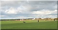
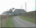
The hamlet of Dothan from Cerrig Cafael Farm
From the left, the buildings include Capel Dothan and the chapel house, Ty'n lon and Ty'n Coed Farms.
Image: © Eric Jones
Taken: 1 Nov 2008
0.10 miles
3
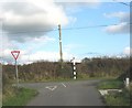
Joining the road linking Bethel with the A5
Image: © Eric Jones
Taken: 1 Nov 2008
0.13 miles
4

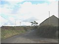
Road junction at the centre of the hamlet of Dothan
The minor road to the right leads to Pencarnisiog and Bryn Du.
Image: © Eric Jones
Taken: 1 Nov 2008
0.14 miles
5
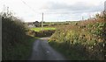
View west towards Capel Dothan chapel and chapel house
Image: © Eric Jones
Taken: 1 Nov 2008
0.14 miles
6
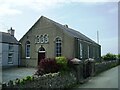
Capel Dothan
This Calvinist chapel dates from 1902. It replaced an earlier chapel built in 1860.
Image: © Eric Jones
Taken: 1 Nov 2008
0.14 miles
9
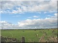
Grazing cattle at Cerrig Cafael Farm
This view, taken north-westwards from the road, extends as far as Holyhead Mountain.
Image: © Eric Jones
Taken: 1 Nov 2008
0.15 miles
10
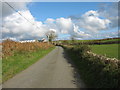
Approaching Dothan crossroads from the Aberffraw direction
Image: © Eric Jones
Taken: 1 Nov 2008
0.16 miles