IMAGES TAKEN NEAR TO
Llanfaelog, TY CROES, LL63 5UE
Introduction
This page details the photographs taken nearby to LL63 5UE by members of the Geograph project.
The Geograph project started in 2005 with the aim of publishing, organising and preserving representative images for every square kilometre of Great Britain, Ireland and the Isle of Man.

There are currently over 7.5m images from over14,400 individuals and you can help contribute to the project by visiting https://www.geograph.org.uk
Image Map
Images are licensed for reuse under creativecommons.org/licenses/by-sa/2.0
Notes
- Clicking on the map will re-center to the selected point.
- The higher the marker number, the further away the image location is from the centre of the postcode.
Image Listing (13 Images Found)
Images are licensed for reuse under creativecommons.org/licenses/by-sa/2.0
Image
Details
Distance
1
Minor road junction between Grug-fawr Farm and Grug-bach
Image: © Eric Jones
Taken: 3 Nov 2008
0.14 miles
4
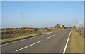
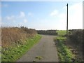
Minor road junction on a long straight stretch of the A 4080
This minor road serves farms south of the Capel Gwyn hamlet.
Image: © Eric Jones
Taken: 3 Nov 2008
0.15 miles
5
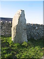
Cvnvgvsi (the Irishman) hic iacit
This standing stone marks the grave of a post-Roman Irish tribal chief by the name of Cunugusus. Irish colonists settled in many parts of the Welsh coastlands once the Romans had withdrawn from Wales. Cunugusus name has survived to the present day in the name of the district. In the Middle Ages, the Welsh form of the name, Conysiog, was the name of the main township in the parish of Llanfaelog. This stood where the modern village of Pencarnisiog stands today. The survival of this place name element for the best part of two millennia is remarkable.
Image: © Eric Jones
Taken: 3 Nov 2008
0.18 miles
6
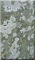
Part of the inscription on Cunugusus' Stone
This inscription on the standing stone at Bodfeddan Farm is in both Latin and Ogam.
http://www.irishmegaliths.org.uk/pillarstones2.htm
Image
Image: © Eric Jones
Taken: 3 Nov 2008
0.19 miles
7
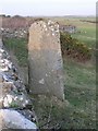
Inscribed Stone, Nr. Pencarnisiog, Anglesey
A view of the inscribed stone that is to be found beside the A4080 near Pencarnisiog (pronounced "Pen Car Nishog"). The inscription is now faint, but appears to be in a runic or "igam-ogam' style.
Image: © Stephen Elwyn RODDICK
Taken: 21 Jan 2006
0.19 miles
9
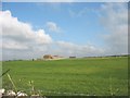
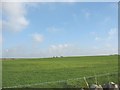
View across improved grassland towards Grug-fawr Farm
Image: © Eric Jones
Taken: 3 Nov 2008
0.21 miles