IMAGES TAKEN NEAR TO
Llangristiolus, BODORGAN, LL62 5RE
Introduction
This page details the photographs taken nearby to LL62 5RE by members of the Geograph project.
The Geograph project started in 2005 with the aim of publishing, organising and preserving representative images for every square kilometre of Great Britain, Ireland and the Isle of Man.

There are currently over 7.5m images from over14,400 individuals and you can help contribute to the project by visiting https://www.geograph.org.uk
Image Map
Images are licensed for reuse under creativecommons.org/licenses/by-sa/2.0
Notes
- Clicking on the map will re-center to the selected point.
- The higher the marker number, the further away the image location is from the centre of the postcode.
Image Listing (12 Images Found)
Images are licensed for reuse under creativecommons.org/licenses/by-sa/2.0
Image
Details
Distance
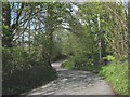
2
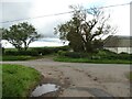
Road junction at Capel Farm
Roads head 3 ways from this junction, whilst ahead is a lane past Capel Farm.
Image: © Gordon Hatton
Taken: 25 Sep 2020
0.06 miles
3
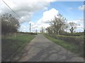
Approaching a minor crossroads by Chapel Farm on the Paradwys-Llanfawr road
Image: © Eric Jones
Taken: 2 May 2008
0.06 miles
4
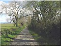
Country road by Tan-yr-Allt Farm
This area is a maze of narrow country lanes.
Image: © Eric Jones
Taken: 2 May 2008
0.09 miles
6
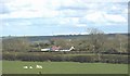
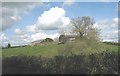
View across the fields to Gwern-rhiwsiar cottage
This idyllic cottage stands besides the road to Paradise Image
Image: © Eric Jones
Taken: 2 May 2008
0.18 miles
7
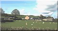
Sheep at Tan-yr-Allt Farm, Llangristiolus
Image: © Eric Jones
Taken: 2 May 2008
0.19 miles
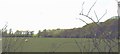
8
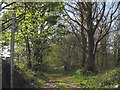
Track with public rights of way through Coed Henblas woods
Image: © Eric Jones
Taken: 2 May 2008
0.19 miles
9
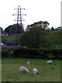
Grazing sheep and a pylon
Sheep grazing in a field near to an electricity pylon
Image: © Nigel Williams
Taken: 3 Jun 2006
0.21 miles
10
Grazing sheep in a field at the edge of Coed Henblas wood
Image: © Eric Jones
Taken: 2 May 2008
0.22 miles