IMAGES TAKEN NEAR TO
Malltraeth, BODORGAN, LL62 5AL
Introduction
This page details the photographs taken nearby to LL62 5AL by members of the Geograph project.
The Geograph project started in 2005 with the aim of publishing, organising and preserving representative images for every square kilometre of Great Britain, Ireland and the Isle of Man.

There are currently over 7.5m images from over14,400 individuals and you can help contribute to the project by visiting https://www.geograph.org.uk
Image Map
Images are licensed for reuse under creativecommons.org/licenses/by-sa/2.0
Notes
- Clicking on the map will re-center to the selected point.
- The higher the marker number, the further away the image location is from the centre of the postcode.
Image Listing (29 Images Found)
Images are licensed for reuse under creativecommons.org/licenses/by-sa/2.0
Image
Details
Distance
1
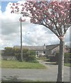
Modern bungalow on the side of the A4080 outside Malltraeth
This is one of three bungalows on this small development.
Image: © Eric Jones
Taken: 7 May 2008
0.01 miles
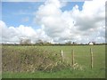
2
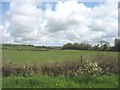
Undulating landscape north-west of Malltraeth
Image: © Eric Jones
Taken: 2 May 2008
0.06 miles
3
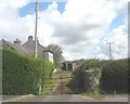
Gwyddfor - on the NW outskirts of Malltraeth
Image: © Eric Jones
Taken: 7 May 2008
0.10 miles
4
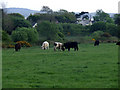
Grazing cattle
Cattle grazing in a field alongside the A4080 road outside Malltraeth
Image: © Nigel Williams
Taken: 13 May 2006
0.11 miles
6
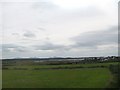
View across farmland towards Malltraeth
The image was taken from the railway line.
Image: © Eric Jones
Taken: 22 Aug 2009
0.15 miles
7
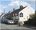
The Royal Oak Inn, Malltraeth
Malltraeth has two pubs - The Royal Oak and The Joiners.
Image: © Eric Jones
Taken: 13 Jun 2008
0.15 miles
8
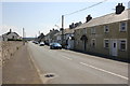
High Street (A4080), Malltraeth
Looking south along High Street (the A4080) at Malltraeth on Anglesey. The pub on the right is The Royal Oak which closed in 2015.
Image: © Jeff Buck
Taken: 3 May 2017
0.17 miles
9
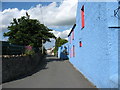
Lane off the High Street by the side of the Post Office
This lane is known as David Street.
Image: © Eric Jones
Taken: 13 Jun 2008
0.18 miles
10
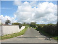
Farm road leading from the A4080 to Ty'n-y-lon
Image: © Eric Jones
Taken: 2 May 2008
0.18 miles