IMAGES TAKEN NEAR TO
Newborough, LLANFAIRPWLLGWYNGYLL, LL61 6TW
Introduction
This page details the photographs taken nearby to LL61 6TW by members of the Geograph project.
The Geograph project started in 2005 with the aim of publishing, organising and preserving representative images for every square kilometre of Great Britain, Ireland and the Isle of Man.

There are currently over 7.5m images from over14,400 individuals and you can help contribute to the project by visiting https://www.geograph.org.uk
Image Map
Images are licensed for reuse under creativecommons.org/licenses/by-sa/2.0
Notes
- Clicking on the map will re-center to the selected point.
- The higher the marker number, the further away the image location is from the centre of the postcode.
Image Listing (9 Images Found)
Images are licensed for reuse under creativecommons.org/licenses/by-sa/2.0
Image
Details
Distance
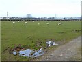
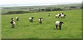
4
Path from Newborough to Llangeinwen Church
Image: © Eric Jones
Taken: 7 Jun 2008
0.15 miles
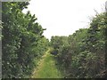
5
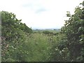
A slightly overgrown section of the Llangeinwen path
Image: © Eric Jones
Taken: 7 Jun 2008
0.20 miles
7
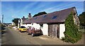
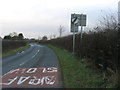
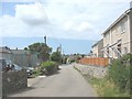
Cottages with a Mobile Christmas Pudding - Newborough
Image: © Anthony Parkes
Taken: 7 Aug 2022
0.23 miles
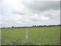
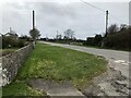
9
Local authority built housing at the upper end of Pen-Dref Street
These occupy land that used to be divided into allotments.
Image: © Eric Jones
Taken: 7 Jun 2008
0.24 miles