IMAGES TAKEN NEAR TO
Rhos Y Gad, LLANFAIRPWLLGWYNGYLL, LL61 5JE
Introduction
This page details the photographs taken nearby to Rhos Y Gad, LL61 5JE by members of the Geograph project.
The Geograph project started in 2005 with the aim of publishing, organising and preserving representative images for every square kilometre of Great Britain, Ireland and the Isle of Man.

There are currently over 7.5m images from over14,400 individuals and you can help contribute to the project by visiting https://www.geograph.org.uk
Image Map
Images are licensed for reuse under creativecommons.org/licenses/by-sa/2.0
Notes
- Clicking on the map will re-center to the selected point.
- The higher the marker number, the further away the image location is from the centre of the postcode.
Image Listing (266 Images Found)
Images are licensed for reuse under creativecommons.org/licenses/by-sa/2.0
Image
Details
Distance
1

Eglwys Unedig Rhos-Y-Gad, Llanfairpwllgwyngyll
Image: © Meirion
Taken: 8 Aug 2025
0.05 miles
2
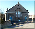
Eglwys Unedig Rhos-Y-Gad in Llanfairpwllgwyngyll
Viewed from Ffordd Penmynydd. The church dates from 1875.
The church nameplate shows the town as Llanfair Pwllgwyngyll, its original name. There are several variants in use, such as Llanfair PG and the sesquipedalian Llanfairpwllgwyngyllgogerychwyrndrobwllllantysiliogogogoch, a concoction made in the 1860s to draw attention to the town. Judging by the number of overseas tourists I saw in the town today, the concoction has been a great success.
Image: © Jaggery
Taken: 26 Mar 2012
0.05 miles
3
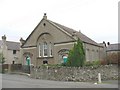
Capel Rhos-y-Gad, Ffordd Penmynydd
This Calvinistic Methodist chapel, which seats 450 people, is now a united chapel, embracing members of other Nonconformist congregations.
Image: © Eric Jones
Taken: 30 Aug 2008
0.05 miles
4
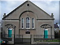
Eglwys Unedig Rhos-Y-Gad
Rhos-Y-Gad Church at Llanfairpwllgwyngyll built in 1875.
Image: © idris
Taken: 7 Mar 2007
0.06 miles
6
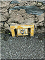
Partially buried Hydrant marker on Trem Eryri, Llanfairpwllgwyngyll
Image: © Meirion
Taken: 11 Nov 2021
0.06 miles
7
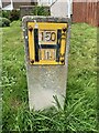
Hydrant marker on Ffordd Rhiannon, Llanfairpwllgwyngyll
Image: © Meirion
Taken: 19 Jul 2024
0.07 miles
8
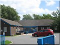
Canolfan Iechyd Llanfairpwllgwyngyll Health Centre
This centre is situated at the lower end of Lon Penmynydd.
Image: © Eric Jones
Taken: 5 Aug 2009
0.08 miles
9
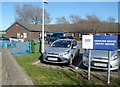
Llanfairpwll Health Centre
Located in Siglan Terrace, Ffordd Penmynydd, the health centre is part of North West Wales NHS Trust.
Image: © Jaggery
Taken: 26 Mar 2012
0.08 miles