IMAGES TAKEN NEAR TO
Llangaffo, GAERWEN, LL60 6NE
Introduction
This page details the photographs taken nearby to LL60 6NE by members of the Geograph project.
The Geograph project started in 2005 with the aim of publishing, organising and preserving representative images for every square kilometre of Great Britain, Ireland and the Isle of Man.

There are currently over 7.5m images from over14,400 individuals and you can help contribute to the project by visiting https://www.geograph.org.uk
Image Map
Images are licensed for reuse under creativecommons.org/licenses/by-sa/2.0
Notes
- Clicking on the map will re-center to the selected point.
- The higher the marker number, the further away the image location is from the centre of the postcode.
Image Listing (12 Images Found)
Images are licensed for reuse under creativecommons.org/licenses/by-sa/2.0
Image
Details
Distance
2

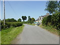
A house above Hengae Quarries
On the map there is only one quarry, but maybe it started as two (or more) smaller quarries.
Image: © David Medcalf
Taken: 7 Apr 2025
0.12 miles
3

Holy Cloud
Looking towards Hengae Quarry, Llangaffo. Snowdon sits centrally in the distance.
Image: © Stephen Elwyn RODDICK
Taken: 25 Jul 2005
0.16 miles

5

A passing place on the lane near Hengae Quarries
It is also a turning area for the field entrance opposite.
Image: © David Medcalf
Taken: 7 Apr 2025
0.20 miles
6
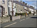
Village street in Llangaffo
On the road from Pont Marquis.
Image: © Oliver Dixon
Taken: 7 Apr 2016
0.21 miles

8

On the road to Llangaffo
After the road crosses the level lowlands of the Afon Cefni the traveller is suddenly confronted with a steep hill at a gradient of 1 in 7 climbing up to Llangaffo, coincident with a geological fault.
Image: © Oliver Dixon
Taken: 7 Apr 2016
0.22 miles