IMAGES TAKEN NEAR TO
Mill Bank Estate, MENAI BRIDGE, LL59 5RD
Introduction
This page details the photographs taken nearby to Mill Bank Estate, LL59 5RD by members of the Geograph project.
The Geograph project started in 2005 with the aim of publishing, organising and preserving representative images for every square kilometre of Great Britain, Ireland and the Isle of Man.

There are currently over 7.5m images from over14,400 individuals and you can help contribute to the project by visiting https://www.geograph.org.uk
Image Map
Images are licensed for reuse under creativecommons.org/licenses/by-sa/2.0
Notes
- Clicking on the map will re-center to the selected point.
- The higher the marker number, the further away the image location is from the centre of the postcode.
Image Listing (14 Images Found)
Images are licensed for reuse under creativecommons.org/licenses/by-sa/2.0
Image
Details
Distance
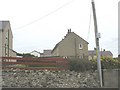
2
School entrance, Llandegfan
The school building is in the adjacent square.
Image: © David Medcalf
Taken: 27 Sep 2007
0.11 miles
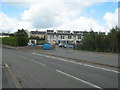
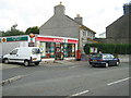
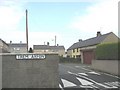
3
Local authority built housing at Llandegfan
Image: © Eric Jones
Taken: 8 Aug 2008
0.11 miles
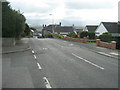
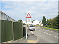
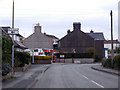
5
Road out of Llandegfan
This is the main road into the 1970s housing estate in Llandegfan, and connects to Lon Ganol. Taken in the early morning.
Image: © Oliver Mills
Taken: 30 Dec 2017
0.14 miles
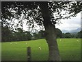
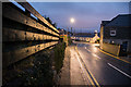
8
Trem Arfon housing estate
Trem Arfon means "Arvon view"
Image: © Eric Jones
Taken: 24 Sep 2008
0.18 miles
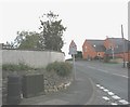
9
The road through Llandegfan
View of the roadscene in Llandegfan
Image: © Nigel Williams
Taken: 27 Apr 2006
0.20 miles