IMAGES TAKEN NEAR TO
Llanddona, BEAUMARIS, LL58 8YF
Introduction
This page details the photographs taken nearby to LL58 8YF by members of the Geograph project.
The Geograph project started in 2005 with the aim of publishing, organising and preserving representative images for every square kilometre of Great Britain, Ireland and the Isle of Man.

There are currently over 7.5m images from over14,400 individuals and you can help contribute to the project by visiting https://www.geograph.org.uk
Image Map
Images are licensed for reuse under creativecommons.org/licenses/by-sa/2.0
Notes
- Clicking on the map will re-center to the selected point.
- The higher the marker number, the further away the image location is from the centre of the postcode.
Image Listing (8 Images Found)
Images are licensed for reuse under creativecommons.org/licenses/by-sa/2.0
Image
Details
Distance
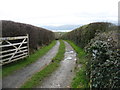
1
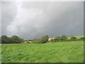
Path across a field of cultivated grass towards the Penhewllys road
Image: © Eric Jones
Taken: 2 Sep 2008
0.07 miles
2
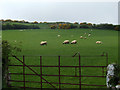
Grazing sheep
Sheep grazing in a field between Llangoed and Llanddona
Image: © Nigel Williams
Taken: 13 May 2006
0.14 miles
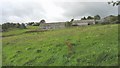
3
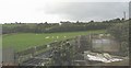
Sheep and sheepfold at Tyddyn-isaf
The white gable in the background belongs to Tyddyn-uchaf (=upper croft).
Image: © Eric Jones
Taken: 2 Sep 2008
0.15 miles
4
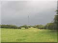
View upslope towards the Llanddona transmission mast
Image: © Eric Jones
Taken: 2 Sep 2008
0.16 miles
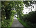
5
The drive to Tyddyn Isaf
This private drive is a public footpath leading to Llangoed.
Image: © David Purchase
Taken: 22 Mar 2014
0.18 miles
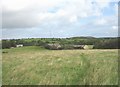
6
View back towards Tan-y-fynwent and Llaniestyn Church
Image: © Eric Jones
Taken: 2 Sep 2008
0.19 miles
7
Path from Llaniestyn Church to the Penhwnllys road
The disused farmhouse in the middle ground is Tan-y-fynwent (= below the cemetery).
Image: © Eric Jones
Taken: 2 Sep 2008
0.22 miles
8
Road climbing uphill as it approaches Cefn Farm
Image: © Eric Jones
Taken: 2 Sep 2008
0.24 miles