IMAGES TAKEN NEAR TO
Llanfaes, BEAUMARIS, LL58 8RL
Introduction
This page details the photographs taken nearby to LL58 8RL by members of the Geograph project.
The Geograph project started in 2005 with the aim of publishing, organising and preserving representative images for every square kilometre of Great Britain, Ireland and the Isle of Man.

There are currently over 7.5m images from over14,400 individuals and you can help contribute to the project by visiting https://www.geograph.org.uk
Image Map
Images are licensed for reuse under creativecommons.org/licenses/by-sa/2.0
Notes
- Clicking on the map will re-center to the selected point.
- The higher the marker number, the further away the image location is from the centre of the postcode.
Image Listing (18 Images Found)
Images are licensed for reuse under creativecommons.org/licenses/by-sa/2.0
Image
Details
Distance
1
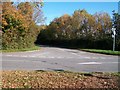
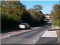
The Penmon Road at its junction with the B5109
Image: © Eric Jones
Taken: 17 Oct 2009
0.07 miles
2
The junction of the Llanfaes Road with the B5109
This image was taken from the abandoned section of the B5109.
Image: © Eric Jones
Taken: 17 Oct 2009
0.08 miles
3
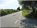
The road from Penmon
Near Llangoed, looking southwest.
Image: © David Medcalf
Taken: 22 Jul 2014
0.11 miles
4
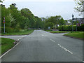
Crossroads on the B5109
Crossroads on the road from Llangoed to Beaumaris, with the road on the left leading to Penmon
Image: © Nigel Williams
Taken: 13 May 2006
0.11 miles
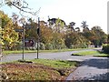
5
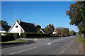
Bungalows at the Llanfaes Parc Estate
The view is taken from the bus stop on the B5109.
Image: © Eric Jones
Taken: 17 Oct 2009
0.11 miles
6
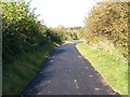
Abandoned section of the B5109
This has been replaced by a new section of road running parallel with the abandoned section.
Image: © Eric Jones
Taken: 17 Oct 2009
0.11 miles
7
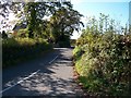
Minor road linking the B5109 with Llanfaes
Image: © Eric Jones
Taken: 17 Oct 2009
0.12 miles
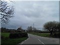
10
The B5109 at the approach to Pont y Brenhin
Image: © Eric Jones
Taken: 17 Oct 2009
0.14 miles