
IMAGES TAKEN NEAR TO
Tregarth, BANGOR, LL57 4PA
Introduction
This page details the photographs taken nearby to LL57 4PA by members of the Geograph project.
The Geograph project started in 2005 with the aim of publishing, organising and preserving representative images for every square kilometre of Great Britain, Ireland and the Isle of Man.

There are currently over 7.5m images from over14,400 individuals and you can help contribute to the project by visiting https://www.geograph.org.uk
Image Map
Images are licensed for reuse under creativecommons.org/licenses/by-sa/2.0
Notes
- Clicking on the map will re-center to the selected point.
- The higher the marker number, the further away the image location is from the centre of the postcode.
Image Listing (17 Images Found)
Images are licensed for reuse under creativecommons.org/licenses/by-sa/2.0
Image
Details
Distance
1
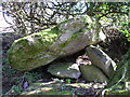
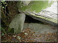
Sling Burial Chamber
Well hidden and somewhat neglected.
Image: © Chris Andrews
Taken: 5 Apr 2015
0.05 miles
3
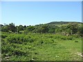
View across a hillside area of rough grazing and woodland
The forest-clad hill in the background is Moel-y-Ci.
Image: © Eric Jones
Taken: 31 May 2008
0.12 miles
4
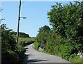
The upward climb to Ysgol Bodfeurig School
Image: © Eric Jones
Taken: 31 May 2008
0.13 miles
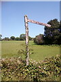
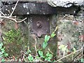


9
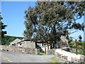
Ysgol Gynradd Bodfeurig Primary School, Sling
Bodfeurig, a small school with around 27 pupils aged 3-11, serves both Sling and Mynydd Llandygai.
Image: © Eric Jones
Taken: 31 May 2008
0.15 miles
10
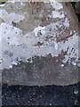
Benchmark on wall opposite Ysgol Bodfeurig, Sling
This benchmark is located on the SW side of the road opposite Ysgol Bodfeurig in Sling & it is shown in the current Ordnance Survey database at a height of 227.8746m above the Newlyn datum.
Image: © Meirion
Taken: 8 Apr 2011
0.19 miles