
IMAGES TAKEN NEAR TO
Llandygai, BANGOR, LL57 4HY
Introduction
This page details the photographs taken nearby to LL57 4HY by members of the Geograph project.
The Geograph project started in 2005 with the aim of publishing, organising and preserving representative images for every square kilometre of Great Britain, Ireland and the Isle of Man.

There are currently over 7.5m images from over14,400 individuals and you can help contribute to the project by visiting https://www.geograph.org.uk
Image Map
Images are licensed for reuse under creativecommons.org/licenses/by-sa/2.0
Notes
- Clicking on the map will re-center to the selected point.
- The higher the marker number, the further away the image location is from the centre of the postcode.
Image Listing (86 Images Found)
Images are licensed for reuse under creativecommons.org/licenses/by-sa/2.0
Image
Details
Distance
1
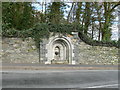
Drinking fountain
Set into the wall of Penrhyn Castle estate. An inscription at the top of the arch states "This fountain was erected by Mrs Dawkins Pennant, Feby 17th 1854".
Image: © Eirian Evans
Taken: 19 Mar 2012
0.05 miles
2
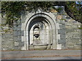
Old drinking fountain with trough, Llandegai
A worn Inscription carved around the inner arch reads ' THIS FOUNTAIN WAS ERECTED / BY / MR. DAWKINS PENNANT / FEBY 17TH 1854 '.
Image: © Meirion
Taken: 7 Mar 2011
0.06 miles
3

St. Tegai's Church, Llandegai
The present Church of St. Tegai in Llandegai dates back to around the 14th century and there was some renovation and modification in the 19th century by the architect Henry Kennedy. See also: Image
Image: © Meirion
Taken: 16 Nov 2010
0.06 miles
4
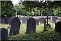
Churchyard of St Tegai, Llandygai
There seem to be different options for spelling, including the village which is also seen locally as Llandegai.
Image: © Bill Boaden
Taken: 18 Sep 2015
0.06 miles
5

The Wyatt family memorial at St. Tegai's Church, Llandegai
The unusual (grade II* listed) Wyatt family memorial in the cemetery at St. Tegai's Church.
Image: © Meirion
Taken: 14 Mar 2011
0.06 miles
6

1GL benchmark & bolt on St. Tegai's Church, Llandegai
This 1GL benchmark & bolt is located in the door jamb on the S transept of St. Tegai's Church in Llandegai was used during the Ordnance Survey's First Primary Levelling on the line between Warrington and Pembroke Docks, between September 1851 and July 1852. This mark was a branch levelling from mark No. 274 on the main levelling line and was 144.820ft above the Liverpool datum. See also: Image
Image: © Meirion
Taken: 16 Nov 2010
0.06 miles
7

St Tegai's Church, Llandygai
The church dates from the 14th Century but has had significant Victorian improvements.
Image: © Bill Boaden
Taken: 18 Sep 2015
0.06 miles


