
IMAGES TAKEN NEAR TO
St. Anns Bethesda, BANGOR, LL57 4BQ
Introduction
This page details the photographs taken nearby to LL57 4BQ by members of the Geograph project.
The Geograph project started in 2005 with the aim of publishing, organising and preserving representative images for every square kilometre of Great Britain, Ireland and the Isle of Man.

There are currently over 7.5m images from over14,400 individuals and you can help contribute to the project by visiting https://www.geograph.org.uk
Image Map
Images are licensed for reuse under creativecommons.org/licenses/by-sa/2.0
Notes
- Clicking on the map will re-center to the selected point.
- The higher the marker number, the further away the image location is from the centre of the postcode.
Image Listing (12 Images Found)
Images are licensed for reuse under creativecommons.org/licenses/by-sa/2.0
Image
Details
Distance
1
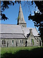
The abandoned St Ann's Church, Bryn Eglwys
Due to structural failure St Ann's Church has been abandoned and a new church set up at the old school at Mynydd Llandygai dedicated to Ss Mary and Ann.
Image: © Eric Jones
Taken: 31 May 2008
0.07 miles
2

Mynwent Eglwys St Ann
This is the cemetery of the now abandoned St Ann's Church.
Image: © Eric Jones
Taken: 31 May 2008
0.08 miles
3

When is a "red" squirrel not a red squirrel?
Answer = When it is a grey squirrel. A grey squirrel may often appear reddish in colour, but is quite distinct from the red squirrel. The dead give-aways are:
a) the halo effect on the tail formed by the band of grey and white hairs, and
b) the absence of tufts around the ears.
Grey squirrels are also found on the ground more frequently than red squirrels.
Image: © Eric Jones
Taken: 31 May 2008
0.08 miles
4
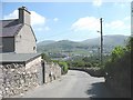
St Ann's Hill
One of the pleasures of childhood was pushing a bicycle up the military road from Deiniolen to the Mynydd Llandegai col and then let rip down the 2km long St Ann's hill to banks of the Ogwen.
Image: © Eric Jones
Taken: 31 May 2008
0.16 miles
5

Fields below St Ann's Church
The Carneddau foothills can be seen in the background with the houses of the Cilfodan and Gerlan districts of Bethesda on their lower slopes.
Image: © Eric Jones
Taken: 31 May 2008
0.19 miles
6
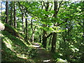
Sun-dappled path through Parc yr Ocar woods.
Image: © Eric Jones
Taken: 31 May 2008
0.21 miles
8
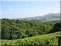
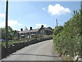
View over bracken covered slope towards Parc yr Ocar woods
Image: © Eric Jones
Taken: 31 May 2008
0.23 miles
9
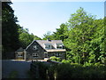
Yr Ocar - a woodland lodge
http://www.yr-ocar.co.uk/contact.htm
Image: © Eric Jones
Taken: 31 May 2008
0.23 miles
10
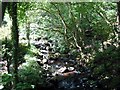
Afon Caledffrwd upstream of Yr Ocar footbridge
Image: © Eric Jones
Taken: 31 May 2008
0.23 miles