
IMAGES TAKEN NEAR TO
Llanllechid, BANGOR, LL57 3YF
Introduction
This page details the photographs taken nearby to LL57 3YF by members of the Geograph project.
The Geograph project started in 2005 with the aim of publishing, organising and preserving representative images for every square kilometre of Great Britain, Ireland and the Isle of Man.

There are currently over 7.5m images from over14,400 individuals and you can help contribute to the project by visiting https://www.geograph.org.uk
Image Map
Images are licensed for reuse under creativecommons.org/licenses/by-sa/2.0
Notes
- Clicking on the map will re-center to the selected point.
- The higher the marker number, the further away the image location is from the centre of the postcode.
Image Listing (23 Images Found)
Images are licensed for reuse under creativecommons.org/licenses/by-sa/2.0
Image
Details
Distance
1

Pasture with molehills
Molehills have been thrown up in abundance in pasture below Sychnant, which is overlooked by one of the many pylons and transmission lines in the area.
Image: © Jonathan Wilkins
Taken: 25 Mar 2017
0.11 miles

3

Rhiw G?ch Stone (close-up), Llanllechid
Large glacial erratic in a field near the prehistoric settlement of Rhiw Gôch just outside Llanllechid. See also: Image
Image: © Meirion
Taken: 1 Mar 2017
0.15 miles
4

Marked stone near the Rhiw G?ch Stone, Llanllechid
Standing next to the large Rhiw Gôch Stone the marks on this smaller stone may be of a natural glacial origin or from the inhabitants of the nearby Rhiw Gôch prehistoric settlement using the stone to sharpen arrowheads.
Image: © Meirion
Taken: 1 Mar 2017
0.15 miles
5

Rhiw G?ch Stone (wide-view), Llanllechid
Large glacial erratic in a field near the prehistoric settlement of Rhiw Gôch just outside Llanllechid. See also: Image
Image: © Meirion
Taken: 1 Mar 2017
0.15 miles
6
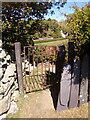
Kissing gate leading to road, Llanllechid
View of gate from road: Image
Image: © Meirion
Taken: 6 May 2020
0.15 miles
7
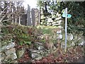
Steps leading up to public footpath, Llanllechid
View of gate from field: Image
Image: © Meirion
Taken: 1 Mar 2017
0.15 miles
8

The site of an early medieval settlement
This site at Rhiw Goch (= red hill) was an enclosed hut group. The 19thC farmhouse in the background is Bryn Owen.
Image: © Eric Jones
Taken: 31 May 2008
0.16 miles
9
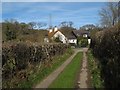
Wern Bach
House at the end of a short lane forming a footpath heading for Sychnant.
Image: © Jonathan Wilkins
Taken: 25 Mar 2017
0.16 miles
10

Flat marked stone near the Rhiw G?ch Stone, Llanllechid
Located close to the large Rhiw Gôch Stone the marks on this flat stone may be of a natural glacial origin or from the inhabitants of the nearby Rhiw Gôch prehistoric settlement using the stone to sharpen arrowheads.
Image: © Meirion
Taken: 1 Mar 2017
0.16 miles