IMAGES TAKEN NEAR TO
Llanllechid, BANGOR, LL57 3SD
Introduction
This page details the photographs taken nearby to LL57 3SD by members of the Geograph project.
The Geograph project started in 2005 with the aim of publishing, organising and preserving representative images for every square kilometre of Great Britain, Ireland and the Isle of Man.

There are currently over 7.5m images from over14,400 individuals and you can help contribute to the project by visiting https://www.geograph.org.uk
Image Map
Images are licensed for reuse under creativecommons.org/licenses/by-sa/2.0
Notes
- Clicking on the map will re-center to the selected point.
- The higher the marker number, the further away the image location is from the centre of the postcode.
Image Listing (38 Images Found)
Images are licensed for reuse under creativecommons.org/licenses/by-sa/2.0
Image
Details
Distance
1
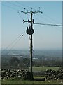
GPO cable marker, Rachub
http://www.ringbell.co.uk/nostalgia/aat.htm
Image: © Meirion
Taken: 8 Aug 2019
0.02 miles
4
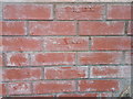
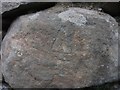
Brick wall with batch numbers showing on Ffordd Tan Y Bwlch, Rachub
Image: © Meirion
Taken: 5 Mar 2020
0.07 miles
7
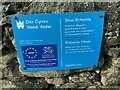
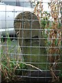
Dŵr Cymru / Welsh Water sign on Britannia Street, Rachub
Image: © Meirion
Taken: 26 Oct 2021
0.11 miles
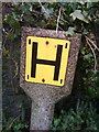
9
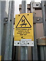
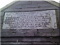
Sign at Tan y Bwlch substation on Tan y Garth, Rachub
Image: © Meirion
Taken: 11 Mar 2021
0.12 miles
