IMAGES TAKEN NEAR TO
Hen Barc, BANGOR, LL57 3RS
Introduction
This page details the photographs taken nearby to Hen Barc, LL57 3RS by members of the Geograph project.
The Geograph project started in 2005 with the aim of publishing, organising and preserving representative images for every square kilometre of Great Britain, Ireland and the Isle of Man.

There are currently over 7.5m images from over14,400 individuals and you can help contribute to the project by visiting https://www.geograph.org.uk
Image Map
Images are licensed for reuse under creativecommons.org/licenses/by-sa/2.0
Notes
- Clicking on the map will re-center to the selected point.
- The higher the marker number, the further away the image location is from the centre of the postcode.
Image Listing (26 Images Found)
Images are licensed for reuse under creativecommons.org/licenses/by-sa/2.0
Image
Details
Distance
1
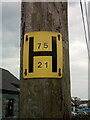
Hydrant sign on telephone pole on Henbarc Road, Bethesda
Image: © Meirion
Taken: 17 Apr 2020
0.02 miles
2
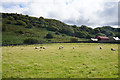
Sheep at Henbarc
The view opposite a row of housing. The land continues climbing beyond what can be seen here, up to the Carneddau.
Image: © Bill Boaden
Taken: 18 Sep 2015
0.03 miles
3
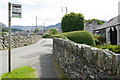
Ffordd Hen Barc, Bethesda
Seen from the junction with Lon Newydd. Buses can be caught here to Bangor although many run via Lon Newydd.
Image: © Stephen McKay
Taken: 7 Aug 2017
0.06 miles
4
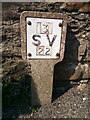
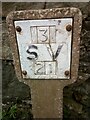
Sluice valve marker on Henbarc Road, Bethesda
Image: © Meirion
Taken: 17 Mar 2020
0.08 miles
5
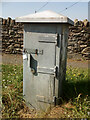
Electrical cabinet on Henbarc Road, Bethesda
Image: © Meirion
Taken: 24 Apr 2020
0.09 miles
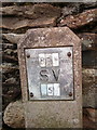
6
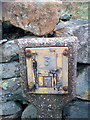
Sluice valve marker on Henbarc Road, Bethesda
Image: © Meirion
Taken: 17 Apr 2020
0.10 miles
7
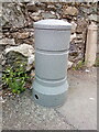
Telemetry bollard on Henbarc Road, Bethesda
Image: © Meirion
Taken: 13 May 2020
0.11 miles
8
Hydrant marker on Coetmor New Road, Bethesda
Image: © Meirion
Taken: 5 Nov 2019
0.11 miles

10
Sluice valve marker on Henbarc Road, Bethesda
Image: © Meirion
Taken: 17 Apr 2020
0.12 miles