
IMAGES TAKEN NEAR TO
Stad Blaen-y-Cae, BANGOR, LL57 3PZ
Introduction
This page details the photographs taken nearby to Stad Blaen-y-Cae, LL57 3PZ by members of the Geograph project.
The Geograph project started in 2005 with the aim of publishing, organising and preserving representative images for every square kilometre of Great Britain, Ireland and the Isle of Man.

There are currently over 7.5m images from over14,400 individuals and you can help contribute to the project by visiting https://www.geograph.org.uk
Image Map
Images are licensed for reuse under creativecommons.org/licenses/by-sa/2.0
Notes
- Clicking on the map will re-center to the selected point.
- The higher the marker number, the further away the image location is from the centre of the postcode.
Image Listing (41 Images Found)
Images are licensed for reuse under creativecommons.org/licenses/by-sa/2.0
Image
Details
Distance
1

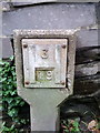
Elizabeth II post box on Braichmelyn, Bethesda
LL57 21
Image: © Meirion
Taken: 10 Jun 2020
0.05 miles
3
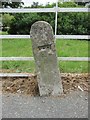
GPO cable marker, Bethesda
http://www.ringbell.co.uk/nostalgia/aat.htm
Image: © Meirion
Taken: 2 Jul 2019
0.07 miles
4
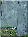
OS benchmark - Bethesda, rock outcrop by bus stop
Located in the living rock beside a bus stop at the road junction, this cutmark was last levelled by the OS at 167.162m above Ordnance Datum Newlyn.
Image: © Richard Law
Taken: 8 Jun 2023
0.08 miles
5
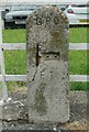
GPO cable marker, Bethesda
http://www.ringbell.co.uk/nostalgia/aat.htm
Image: © Meirion
Taken: 2 Jul 2019
0.08 miles
6
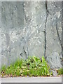
Benchmark in rock outcrop near Ty'n Twr, Bethesda
This benchmark is located in a rock outcrop on the E side of the road near Ty'n Twr in Bethesda and it is shown in the current Ordnance Survey database at a height of 151.9672m above the Newlyn datum.
Image: © Meirion
Taken: 23 Sep 2011
0.08 miles
8
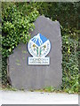
Snowdonia National Park boundary marker, Bethesda
Image: © Meirion
Taken: 23 Sep 2011
0.10 miles
9
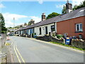
Slate workers' cottages on Braichmelyn
Very similar in style to, but rather more modernised than, the row of cottages which is Grade II listed at Image
Image: © Richard Law
Taken: 10 Aug 2023
0.11 miles
10
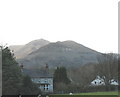
Houses near Penrhyn Quarry
The houses shown here are typical of those built in the Victorian hey-day of the slate industry. The style is common to all quarrying towns and villages. Behind the houses, the galleries and tips of the Penrhyn Quarry can be seen on the side of the Fronllwyd. The other two mountains in the background are Carnedd y Filiast and Mynydd Perfedd.
Image: © Eric Jones
Taken: 1 Apr 2006
0.11 miles