
IMAGES TAKEN NEAR TO
Off Lower High Street, BANGOR, LL57 1YX
Introduction
This page details the photographs taken nearby to Off Lower High Street, LL57 1YX by members of the Geograph project.
The Geograph project started in 2005 with the aim of publishing, organising and preserving representative images for every square kilometre of Great Britain, Ireland and the Isle of Man.

There are currently over 7.5m images from over14,400 individuals and you can help contribute to the project by visiting https://www.geograph.org.uk
Image Map
Images are licensed for reuse under creativecommons.org/licenses/by-sa/2.0
Notes
- Clicking on the map will re-center to the selected point.
- The higher the marker number, the further away the image location is from the centre of the postcode.
Image Listing (224 Images Found)
Images are licensed for reuse under creativecommons.org/licenses/by-sa/2.0
Image
Details
Distance
2
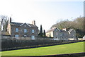
Ffordd Pen-y-bryn
A short street of mainly Georgian detached dwellings
Image: © Eric Jones
Taken: 27 Mar 2007
0.01 miles
3
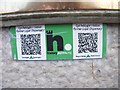
HiPoints information QR code for the former Loyal Dispensary, Bangor
HistoryPoints.org brings local history to your mobile phone. Main website at http://historypoints.org
See also Image
Image: © Meirion
Taken: 28 May 2019
0.03 miles
4
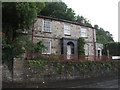
Former Loyal Dispensary, Bangor
The building is currently home to a veterinary surgery.
See also: Image
Image: © Meirion
Taken: 7 Jun 2019
0.03 miles
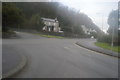
6
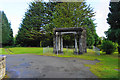
Standalone entrance on the edge of Bangor
The inscription, in Welsh, states that this was the site of the Penrhyn Arms hotel from 1799 to 1884 and then the first home of the university college of North Wales.
Image: © Bill Boaden
Taken: 18 Sep 2015
0.04 miles
7
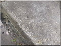
Rivet benchmark on High Street, Bangor
This rivet benchmark is located on a low wall just off the High Street in Bangor & it is shown in the current Ordnance Survey database at a height of 19.0832m above the Newlyn datum.
Image: © Meirion
Taken: 5 May 2011
0.04 miles
8
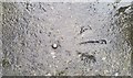
Ordnance Survey Rivet
This OS rivet can be found on the wall south side of the road. It marks a point 19.083m above mean sea level.
Image: © Adrian Dust
Taken: 31 Jan 2017
0.04 miles
9
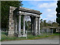
Penrhyn Arms portico
Formerly the portico at the main entrance to the Penrhyn Arms Hotel built in 1799 by Benjamin Wyatt. In 1884 it became the first home of the University College of North Wales. The University moved to new buildings in 1926 and the hotel was later demolished to enable the A5 to be re-routed slightly to the North. At the centre is a slate plaque reading: "1799-1884 Yma Y Safai Gwesty’r "Penrhyn Arms" Cartref Cyntaf Coleg Prifysgol Gogledd Cymru 1884-1926".
Image: © Eirian Evans
Taken: 19 Mar 2012
0.04 miles
10
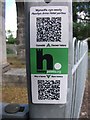
HiPoints information QR code for the Penrhyn Arms Hotel portico, Bangor
HistoryPoints.org brings local history to your mobile phone. Main website at http://historypoints.org
See also Image
Image: © Meirion
Taken: 12 Jun 2019
0.04 miles