IMAGES TAKEN NEAR TO
High Street, BANGOR, LL57 1YR
Introduction
This page details the photographs taken nearby to High Street, LL57 1YR by members of the Geograph project.
The Geograph project started in 2005 with the aim of publishing, organising and preserving representative images for every square kilometre of Great Britain, Ireland and the Isle of Man.

There are currently over 7.5m images from over14,400 individuals and you can help contribute to the project by visiting https://www.geograph.org.uk
Image Map
Images are licensed for reuse under creativecommons.org/licenses/by-sa/2.0
Notes
- Clicking on the map will re-center to the selected point.
- The higher the marker number, the further away the image location is from the centre of the postcode.
Image Listing (253 Images Found)
Images are licensed for reuse under creativecommons.org/licenses/by-sa/2.0
Image
Details
Distance
1
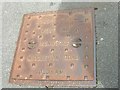
Manhole cover on High Street, Bangor
CLEVELAND MOTOR SPIRIT
JOSEPH TOOLE
WEST END
IRONWORKS
MIDDLETON ROAD
OLDHAM
CLEVELAND MOTOR SPIRIT
Image: © Meirion
Taken: 19 Jun 2019
0.01 miles
3
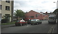
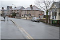
The former Kwik-Save store in the Lower High Street
This was one of two Kwik-Save/Somerfield stores in Bangor. The one in Caernarfon road is still open but the High Street branch was closed when Somerfield disposed of its Kwik-Save stores. The building on the left is the Bangor tax office.
Image: © Eric Jones
Taken: 11 May 2007
0.02 miles
5
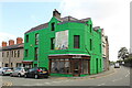
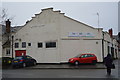
Tŷ Gwydr - Greenhouse
Is an independent, community-owned social enterprise. It aims to support and promote community activities. A not for profit organisation.
Image: © Richard Hoare
Taken: 10 Jun 2022
0.03 miles
8
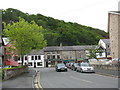
The junction of Glynne Road and High Street, Bangor
Image: © Eric Jones
Taken: 11 May 2007
0.03 miles
9
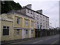
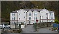
Friars Terrace, Bangor
The terrace is in the background and is a listed late Georgian building. The building in the foreground was for many years a bicycle shop and is built on the site of an earlier toll house.
Image: © Chris Andrews
Taken: 31 May 2014
0.03 miles