IMAGES TAKEN NEAR TO
High Street, BANGOR, LL57 1NR
Introduction
This page details the photographs taken nearby to High Street, LL57 1NR by members of the Geograph project.
The Geograph project started in 2005 with the aim of publishing, organising and preserving representative images for every square kilometre of Great Britain, Ireland and the Isle of Man.

There are currently over 7.5m images from over14,400 individuals and you can help contribute to the project by visiting https://www.geograph.org.uk
Image Map
Images are licensed for reuse under creativecommons.org/licenses/by-sa/2.0
Notes
- Clicking on the map will re-center to the selected point.
- The higher the marker number, the further away the image location is from the centre of the postcode.
Image Listing (438 Images Found)
Images are licensed for reuse under creativecommons.org/licenses/by-sa/2.0
Image
Details
Distance
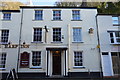
1
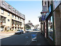
Apartments and shops in the upper part of the High Street
Image: © Eric Jones
Taken: 30 Apr 2007
0.00 miles
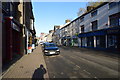
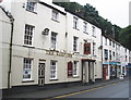
3
New Private Student Hostel on the British Hotel site
Image: © Eric Jones
Taken: 24 Jul 2009
0.01 miles
4
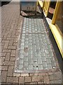
Pavement light on the High Street, Bangor
HAYWARD - LIMITED - MAKERS - LONDON
Image: © Meirion
Taken: 2 Aug 2019
0.01 miles
5
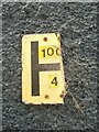
Damaged hydrant sign on the High Street, Bangor
Image: © Meirion
Taken: 7 May 2020
0.01 miles
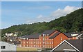
8
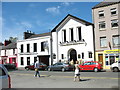
The former Our Lady's Church and Presbytery now known as the Black Bull Inn
The Black Bull is a Wetherspoon pub.
Image: © Eric Jones
Taken: 30 Apr 2007
0.02 miles
9
Harp Inn
Grade II listed. http://www.britishlistedbuildings.co.uk/wa-4030-nos-78-82-even-including-attached-former-o
Image: © N Chadwick
Taken: 21 Feb 2015
0.03 miles
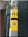
10
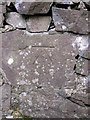
Benchmark on wall along public footpath#3, Bangor
This benchmark is located on the SE wall along a public footpath which runs between the High Street and Hendrewen in Bangor. The mark is not shown in the current Ordnance Survey database but is shown on an 1900 map of the area at a height of 119.8ft above the Liverpool datum.
Image: © Meirion
Taken: 24 May 2011
0.03 miles