
IMAGES TAKEN NEAR TO
Caeathro, CAERNARFON, LL55 4HJ
Introduction
This page details the photographs taken nearby to LL55 4HJ by members of the Geograph project.
The Geograph project started in 2005 with the aim of publishing, organising and preserving representative images for every square kilometre of Great Britain, Ireland and the Isle of Man.

There are currently over 7.5m images from over14,400 individuals and you can help contribute to the project by visiting https://www.geograph.org.uk
Image Map
Images are licensed for reuse under creativecommons.org/licenses/by-sa/2.0
Notes
- Clicking on the map will re-center to the selected point.
- The higher the marker number, the further away the image location is from the centre of the postcode.
Image Listing (15 Images Found)
Images are licensed for reuse under creativecommons.org/licenses/by-sa/2.0
Image
Details
Distance
1
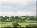
Y Garth - A Pastoral Farm
The moist climate and heavy glacial soils favour the growth of grass. The farmer keeps cattle and sheep. The farmhouse is on the right and the new bungalow (left) has been built under the agricultural tenancy scheme for the use of the farmer's son and his family. Such houses can only be resold to people engaged in agriculture.
Image: © Eric Jones
Taken: 14 Aug 2006
0.02 miles
2
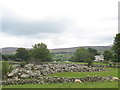
A Modern Cairn at Garth Farm
This cairn is the result of land clearance.
Image: © Eric Jones
Taken: 12 Aug 2006
0.06 miles
3
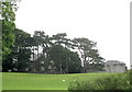
Fferm Caehoedyn Farm
This homestead has a walled farmyard with particularly fine outbuildings
Image: © Eric Jones
Taken: 12 Aug 2006
0.11 miles

6
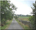
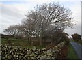
Country lane near Pant Ifan
This lane is used mainly by farmers to gain access to their fields. The narrowness of the road, its steep hills and sharp bends tend to deter other motorists.
Image: © Eric Jones
Taken: 12 Aug 2006
0.17 miles
8
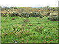
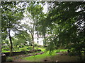
Overgrown wetland
Autumn colours are shown by trees growing in a small wet depression, which has temporarily dried out.
Image: © Jonathan Wilkins
Taken: 14 Oct 2011
0.20 miles
9
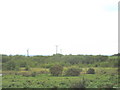
An Infilled Kettle Lake at Prysgol
Fifty years ago, there was a large shallow lake here, and the farmer at Prysgol recalls that his father used to dip sheep in it. Since then the lake has become a seasonal feature and additional trees have been planted around it under a conservation scheme.
Image: © Eric Jones
Taken: 14 Aug 2006
0.21 miles
10
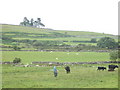
Daily Check on Grazing Stock
Farmer does his daily stock check round. This is marginal land between the lower slopes of Cefn Du and the more productive drumlin land immediately to the north.
Image: © Eric Jones
Taken: 12 Aug 2006
0.21 miles