IMAGES TAKEN NEAR TO
Cwm-y-Glo, CAERNARFON, LL55 4EA
Introduction
This page details the photographs taken nearby to LL55 4EA by members of the Geograph project.
The Geograph project started in 2005 with the aim of publishing, organising and preserving representative images for every square kilometre of Great Britain, Ireland and the Isle of Man.

There are currently over 7.5m images from over14,400 individuals and you can help contribute to the project by visiting https://www.geograph.org.uk
Image Map
Images are licensed for reuse under creativecommons.org/licenses/by-sa/2.0
Notes
- Clicking on the map will re-center to the selected point.
- The higher the marker number, the further away the image location is from the centre of the postcode.
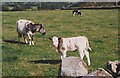
Image Listing (39 Images Found)
Images are licensed for reuse under creativecommons.org/licenses/by-sa/2.0
Image
Details
Distance
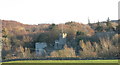
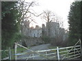
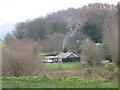
3
Castell Bryn Bras from the fields of Cefn Llwyd Farm
Image: © Eric Jones
Taken: 9 May 2010
0.11 miles
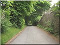
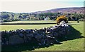
7
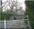
The gate entrance to Castell Bryn Bras Castle
Image: © Eric Jones
Taken: 25 Jan 2007
0.12 miles
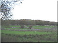
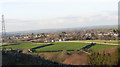
10
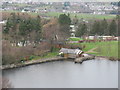
The Dam and Lakeside Cafe at Llyn Bryn Bras
Image: © Eric Jones
Taken: 26 Dec 2006
0.13 miles