
IMAGES TAKEN NEAR TO
Bryn Eglwys, CAERNARFON, LL55 3HE
Introduction
This page details the photographs taken nearby to Bryn Eglwys, LL55 3HE by members of the Geograph project.
The Geograph project started in 2005 with the aim of publishing, organising and preserving representative images for every square kilometre of Great Britain, Ireland and the Isle of Man.

There are currently over 7.5m images from over14,400 individuals and you can help contribute to the project by visiting https://www.geograph.org.uk
Image Map
Images are licensed for reuse under creativecommons.org/licenses/by-sa/2.0
Notes
- Clicking on the map will re-center to the selected point.
- The higher the marker number, the further away the image location is from the centre of the postcode.
Image Listing (50 Images Found)
Images are licensed for reuse under creativecommons.org/licenses/by-sa/2.0
Image
Details
Distance
1
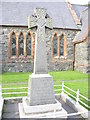
The St Helen's War Memorial, Penisa'r Waun
This is a memorial to members of the church lost in both World Wars. Seven lads did not return from the first and one from the second.
Image: © Eric Jones
Taken: 21 Sep 2006
0.02 miles
2
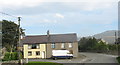
'The King Arthur' - A Former Pub
Known locally as 'King', this building is one of a number of disappeared pubs in the area, their closure being brought about by the religious revival of 1904-05. Others nearby include 'The Ship' and 'The Crown'. Only their names remain. After years as a single dwelling, the 'King' has, in recent years, been divided into apartments. In Victorian times, the pub gained trade, and its name, from the fact that it was close to Ffynnon Cegin Arthur (Arthur's Kitchen Well)- a chalybeate spring - once the resort of people taking the waters, but now hidden by thick forest.
Image: © Eric Jones
Taken: 21 Sep 2006
0.02 miles
5
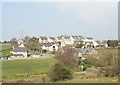
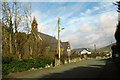
Penisarwaen's 'west end' seen from the Stabla path
This end of the village has only been developed in the last two decades. Previously the only buildings in this area were the school, the church (the steeple of which peeps above the roofline) and the former King Arthur pub (behind the pylon).
Image: © Eric Jones
Taken: 31 Mar 2007
0.03 miles
6
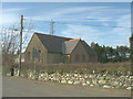
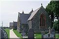
Santes Helen Church Hall
This is located next St Helen's CinW Church.
Image: © Eric Jones
Taken: 2 Mar 2008
0.03 miles
10
The western outskirts of Penisarwaen
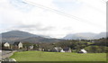
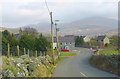
This village, now variously called Penisa'r Waun and Penisarwaun (=lower end of the moor) by officialdom depending on their mood and the weather, is still written by the locals as Penisarwaen and pronounced Pen-Sar-Weun. Who said Welsh was a phonetic language where what you see is what you say?
Image: © Eric Jones
Taken: 2 Mar 2008
0.06 miles