
IMAGES TAKEN NEAR TO
Llanddeiniolen, CAERNARFON, LL55 3AG
Introduction
This page details the photographs taken nearby to LL55 3AG by members of the Geograph project.
The Geograph project started in 2005 with the aim of publishing, organising and preserving representative images for every square kilometre of Great Britain, Ireland and the Isle of Man.

There are currently over 7.5m images from over14,400 individuals and you can help contribute to the project by visiting https://www.geograph.org.uk
Image Map
Images are licensed for reuse under creativecommons.org/licenses/by-sa/2.0
Notes
- Clicking on the map will re-center to the selected point.
- The higher the marker number, the further away the image location is from the centre of the postcode.
Image Listing (20 Images Found)
Images are licensed for reuse under creativecommons.org/licenses/by-sa/2.0
Image
Details
Distance
1
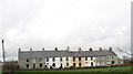
Tai Cae Rhos
The two houses on the right hand side of the terrace were still owned by the Faenol Estate in 1967. The two up, two down + kitchen houses each commanded an annual rent of £18.
Image
Image: © Eric Jones
Taken: 10 Mar 2007
0.02 miles
2
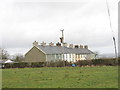
Tai Cae Rhos
Tai Cae Rhos can be translated at 'heath field houses'.
Image: © Eric Jones
Taken: 10 Mar 2007
0.02 miles
3

Tai Cae Rhos
Terraced houses at Seion
Image: © Nigel Williams
Taken: 12 Feb 2006
0.03 miles
5

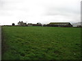
Fferm Llys-y-gwynt
In 1967, at the break-up of the Faenol Estate, Llys-y-gwynt (court of the wind) was a 45 acre dairy farm, 27 acres of which was arable land and only 4 acres rough pasture. The house had also been recently fully modernised at 'an estimated cost of £1,069'. Farmers in this area have long switched from dairying to stock rearing.
Image: © Eric Jones
Taken: 10 Mar 2007
0.10 miles
7
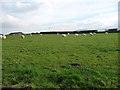
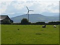
Sheep grazing near Llys Gwynt, Seion
About 135 metres above sea level.
Image: © Christine Johnstone
Taken: 24 Nov 2018
0.15 miles
8
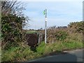
Metal and slate kissing gate, Seion
At the entrance to the public footpath heading north-west to Tan yr Wylfa.
Image: © Christine Johnstone
Taken: 24 Nov 2018
0.16 miles
9
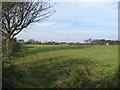
Public footpath from Seion to Tan yr Wylfa
Hugging the edge of the field.
Image: © Christine Johnstone
Taken: 24 Nov 2018
0.16 miles
10
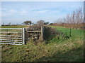
Route of the footpath to Tan yr Wylfa
Walkers must cross the green tape fence to go along the right / east side of the nearest hedge.
Image: © Christine Johnstone
Taken: 24 Nov 2018
0.17 miles