
IMAGES TAKEN NEAR TO
Llys Yr Eifl, CAERNARFON, LL55 2LJ
Introduction
This page details the photographs taken nearby to Llys Yr Eifl, LL55 2LJ by members of the Geograph project.
The Geograph project started in 2005 with the aim of publishing, organising and preserving representative images for every square kilometre of Great Britain, Ireland and the Isle of Man.

There are currently over 7.5m images from over14,400 individuals and you can help contribute to the project by visiting https://www.geograph.org.uk
Image Map
Images are licensed for reuse under creativecommons.org/licenses/by-sa/2.0
Notes
- Clicking on the map will re-center to the selected point.
- The higher the marker number, the further away the image location is from the centre of the postcode.
Image Listing (85 Images Found)
Images are licensed for reuse under creativecommons.org/licenses/by-sa/2.0
Image
Details
Distance
1
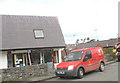
Sglodion Lorna's Chippy - Cae Ymryson Estate
Image: © Eric Jones
Taken: 26 Oct 2006
0.04 miles
2
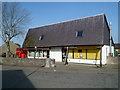
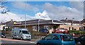
Chip shop and post office, Ffordd Eryri, Caernarfon
The post office is on the left. The name on the right is Siop Chips Dyl Hendre.
Image: © Jaggery
Taken: 25 Mar 2012
0.04 miles
3
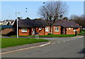
Llys y Foel Bungalows, Caernarfon
Viewed from Ffordd Eryri.
Image: © Jaggery
Taken: 25 Mar 2012
0.06 miles
5
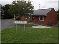
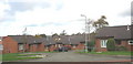
Caernarfon: Bungalo?s Bungalows
This little row of bungalows, named Llys y Foel on the sign, has a curious English version given below in smaller lettering.
Image: © Chris Downer
Taken: 14 Aug 2013
0.10 miles
7
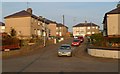
Bro Helen, Caernarfon
Bro Helen is a T-shaped cul-de-sac viewed here across South Road (A487).
Houses facing the camera in the distance are along the top of the T shape.
Image: © Jaggery
Taken: 23 Mar 2012
0.12 miles
8
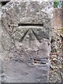
Benchmark on South Road, Caernarfon
This benchmark is located on the W side of South Road (Lôn Parc) on what is now the wall of the Tesco car park in Caernarfon & it is shown on an 1891 map of the area at a height of 63.1ft above the Liverpool datum.
Image: © Meirion
Taken: 20 Jul 2011
0.12 miles
9
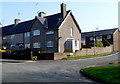
Corner of Llys Tryfan and Ffordd Eryri, Caernarfon
Llys Tryfan is on the right.
Image: © Jaggery
Taken: 25 Mar 2012
0.13 miles
10
Ysgol yr Hendre Primary School
This school has a catchment area which includes the Hendre Estate of private housing and the large local authority estates between the Llanbeblig and Llanberis roads.
Image: © Eric Jones
Taken: 26 Oct 2006
0.13 miles