
IMAGES TAKEN NEAR TO
Bethel, CAERNARFON, LL55 1UU
Introduction
This page details the photographs taken nearby to LL55 1UU by members of the Geograph project.
The Geograph project started in 2005 with the aim of publishing, organising and preserving representative images for every square kilometre of Great Britain, Ireland and the Isle of Man.

There are currently over 7.5m images from over14,400 individuals and you can help contribute to the project by visiting https://www.geograph.org.uk
Image Map
Images are licensed for reuse under creativecommons.org/licenses/by-sa/2.0
Notes
- Clicking on the map will re-center to the selected point.
- The higher the marker number, the further away the image location is from the centre of the postcode.
Image Listing (24 Images Found)
Images are licensed for reuse under creativecommons.org/licenses/by-sa/2.0
Image
Details
Distance
2
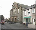
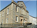
Capel Bethel Chapel
It was this Congregational Chapel which gave the village its name.
Image: © Eric Jones
Taken: 24 Mar 2008
0.03 miles
4
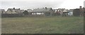
Houses in Tan-y-cae seen from Tan-y-ffordd
Image: © Eric Jones
Taken: 24 Mar 2008
0.06 miles
6
Approaching Pont Charlie from the west
A gate has been erected to stop sheep climbing up the steps. They are about the only would-be users these days.
Image: © Eric Jones
Taken: 25 Dec 2006
0.10 miles
7
The Caernarfon end of Bethel village
The Caernarfon end of the village of Bethel. Before being linked by new estates, the village consisted of two separate clusters of houses, Bethel and Saron, each grouped around a chapel of the same name. The chapel shown here is Bethel.
Image: © Eric Jones
Taken: 25 Dec 2006
0.10 miles
8
Ysgol Gynradd, Bethel
The Bethel Primary School located on the B4366 which runs through the village.
Image: © Eric Jones
Taken: 25 Dec 2006
0.10 miles
9
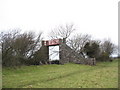
Pont Charlie - the bridge that goes nowhere
Pont Charlie - named after Charles Garden Duff Assheton-Smith, the owner of Dinorwig Quarry - was built to cross the quarry railway line. The line closed almost half a century ago but the bridge still survives.
Image: © Eric Jones
Taken: 25 Dec 2006
0.10 miles
10
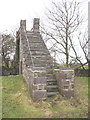
Pont Charlie
As befits a quarry line footbridge, Pont Charlie is built of slate.
Image: © Eric Jones
Taken: 25 Dec 2006
0.10 miles