
IMAGES TAKEN NEAR TO
Griffiths Crossing, CAERNARFON, LL55 1TS
Introduction
This page details the photographs taken nearby to LL55 1TS by members of the Geograph project.
The Geograph project started in 2005 with the aim of publishing, organising and preserving representative images for every square kilometre of Great Britain, Ireland and the Isle of Man.

There are currently over 7.5m images from over14,400 individuals and you can help contribute to the project by visiting https://www.geograph.org.uk
Image Map
Images are licensed for reuse under creativecommons.org/licenses/by-sa/2.0
Notes
- Clicking on the map will re-center to the selected point.
- The higher the marker number, the further away the image location is from the centre of the postcode.
Image Listing (30 Images Found)
Images are licensed for reuse under creativecommons.org/licenses/by-sa/2.0
Image
Details
Distance
1
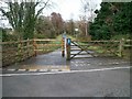
Lon Menai Cycleway east of Griffith's Crossing
This follows the line of the disused Banor to Afon Wen railway line.
Image: © Eric Jones
Taken: 25 Nov 2009
0.01 miles
2
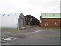
Industrial Units at the Griffith's Crossing Industrial Estate
Image: © Eric Jones
Taken: 25 Nov 2009
0.02 miles
3
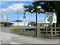
Griffiths Crossing Trading Estate
Griffiths Crossing was originally a station on the Menai Bridge to Afon Wen line. The last trains went through here in 1972.
Image: © Eirian Evans
Taken: 9 Aug 2012
0.05 miles
5

Nissen Huts at Griffiths Crossing Trading Estate
Two of several Nissen huts on the estate.
Image: © Jeff Buck
Taken: 14 Jun 2017
0.06 miles
6

Entrance to Griffiths Crossing Trading Estate
The entrance to Griffiths Crossing Trading Estate next to the Wales Coast Path.
Image: © Jeff Buck
Taken: 14 Jun 2017
0.06 miles
7
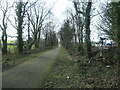
This way to Griffiths Crossing and Caernarfon
Lon Las Menai, heading south-west. Built on the track bed of the former railway between Bangor and Caernarfon.
Image: © Christine Johnstone
Taken: 12 Mar 2022
0.07 miles
8

Old Milestone
Old milestone next to the A.487 near to Betel, Gwynedd for overall view see http://www.geograph.org.uk/photo/5373803
Image: © Keith Evans
Taken: 27 Apr 2017
0.09 miles
9
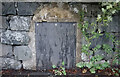
Old Milestone by A487, Llanfair-is-gaer, Parciau, opposite entrance to Griffins Industrial estate, below row of houses
The Milestone is located set in stone wall on the East of the road. Parish of Y Felinheli (Gwynedd District), erected in the 20th Century, V has been defaced.
Inscription reads:-
CAERNARVON / 2 / BANGOR / 7
Grade II listed. List Entry Number: 18338 https://historicengland.org.uk/listing/the-list/list-entry/18338
Milestone Society National ID: CAE_BGCV07
Image: © David Elis-Williams
Taken: 20 Jun 2020
0.10 miles
10

The Wales Coast Path
The Wales Coast Path heading east away from Caernarfon. The Wales Coast Path at this point follows the trackbed of the former Bangor to Caernarfon railway line.
Image: © Jeff Buck
Taken: 14 Jun 2017
0.12 miles