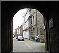
IMAGES TAKEN NEAR TO
CAERNARFON, LL55 1SN
Introduction
This page details the photographs taken nearby to LL55 1SN by members of the Geograph project.
The Geograph project started in 2005 with the aim of publishing, organising and preserving representative images for every square kilometre of Great Britain, Ireland and the Isle of Man.

There are currently over 7.5m images from over14,400 individuals and you can help contribute to the project by visiting https://www.geograph.org.uk
Image Map
Images are licensed for reuse under creativecommons.org/licenses/by-sa/2.0
Notes
- Clicking on the map will re-center to the selected point.
- The higher the marker number, the further away the image location is from the centre of the postcode.
Image Listing (1555 Images Found)
Images are licensed for reuse under creativecommons.org/licenses/by-sa/2.0
Image
Details
Distance
1
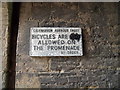
Bicycles are not allowed on the promenade, Caernarfon
This sign is located within the arch of Porth-yr-aur in Caernarfon. As this sign is not bi-lingual and has the defunct spelling of Caernarfon it is quite likely a very old sign.
Image: © Meirion
Taken: 12 Aug 2011
0.00 miles
2
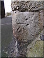
Benchmark on archway on Y Promen?d, Caernarfon
This benchmark is located on the S face of at stone archway on Y Promenâd in Caernarfon & it is shown in the current Ordnance Survey database at a height of 5.1600m above the Newlyn datum.
Image: © Meirion
Taken: 11 Mar 2011
0.01 miles
3
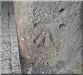
Ordnance Survey Cut Mark
This OS cut mark can be found on the south face of the Arch on Y Promenad. it marks a point 5.160m above mean sea level.
Image: © Adrian Dust
Taken: 29 Sep 2016
0.01 miles
4
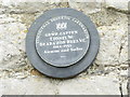
Grŵp Gapten Lionel W. Brabazon Rees V.C. 1884 - 1955, Caernarfon
A Caernarfon Civic Society plaque on the outer wall of the Royal Welsh Yacht Club to Group Captain Lionel Wilmot Brabazon Rees V.C.
Image: © Meirion
Taken: 12 Aug 2011
0.01 miles
5
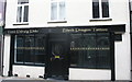
A Tattooist Studio in High Street
Until well into the 20thC, the High Street, within the walled town, was Caernarfon's commercial centre. Today, it contains, especially at its seaward end, a number of small specialist service outlets such as this.
Image: © Eric Jones
Taken: 3 Sep 2006
0.01 miles
7
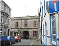
Porth yr Aur or West Gate
Porth yr Aur leads out to the promenade. The gate building has been occupied since the 19th century by the prestigious Royal Welsh Yacht Club.
Image: © Eric Jones
Taken: 30 Oct 2006
0.01 miles
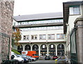
9
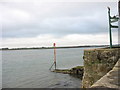
Danger marker on jetty at Porth yr Aur
This jetty which is submerged at high tide constitutes a navigational hazard as the channel leading to the Slate Quay runs close by.
Image: © Eric Jones
Taken: 30 Oct 2006
0.01 miles