
IMAGES TAKEN NEAR TO
Twthill East, CAERNARFON, LL55 1PF
Introduction
This page details the photographs taken nearby to Twthill East, LL55 1PF by members of the Geograph project.
The Geograph project started in 2005 with the aim of publishing, organising and preserving representative images for every square kilometre of Great Britain, Ireland and the Isle of Man.

There are currently over 7.5m images from over14,400 individuals and you can help contribute to the project by visiting https://www.geograph.org.uk
Image Map
Images are licensed for reuse under creativecommons.org/licenses/by-sa/2.0
Notes
- Clicking on the map will re-center to the selected point.
- The higher the marker number, the further away the image location is from the centre of the postcode.
Image Listing (436 Images Found)
Images are licensed for reuse under creativecommons.org/licenses/by-sa/2.0
Image
Details
Distance
1
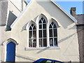
Dennis the Menace and Friends stare out of the windows of the old Catholic Church
With the transference of services from St Helen's Church to the former Anglican St David Church (now called St David and St Helen), at the other end of Twthill Image, the building has been adapted for the purposes of Y Cylch Meithrin - the Nursery Circle - which caters for youngsters below the age of 3.
http://www.jedisparadise.co.uk/childrenstv/Dennis%20and%20Gnasher/Dennis%20and%20Gnasher.htm
Image: © Eric Jones
Taken: 15 Oct 2006
0.03 miles
2
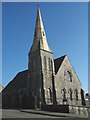
The Roman Catholic church of St David and St Helen
Image: © Eric Jones
Taken: 24 Oct 2007
0.03 miles
3
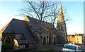
Church of St David and St Helen, Caernarfon
The Roman Catholic church in Twthill East is in the Diocese of Wrexham.
Image: © Jaggery
Taken: 26 Mar 2012
0.04 miles
4
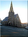
Church spire, Caernarfon
Looking across Twthill East towards the Roman Catholic
Church of St David and St Helen, on the corner of Thomas Street.
Image: © Jaggery
Taken: 26 Mar 2012
0.04 miles
5

Flush bracket S7216 on the Twthill triangulation pillar, Caernarfon
Image: © Meirion
Taken: 8 Sep 2011
0.04 miles
6

Trig point on Twt Hill
Twt Hill is a low rise close to the centre of Caernarfon; the view beyond the pillar is to the south over the town.
Image: © Trevor Littlewood
Taken: 11 Sep 2005
0.04 miles
7
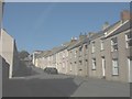
Heol Elinor Street, Twthill
This is a street of Victorian houses.
Image: © Eric Jones
Taken: 24 Oct 2007
0.04 miles
8
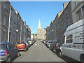
View up Thomas Street towards the Catholic Church
Image: © Eric Jones
Taken: 24 Oct 2007
0.04 miles
9

Cave on Twthill
Twthill (a corruption of the English 'Shoothill') is a large outcrop of ancient igneous rock which dominates the town of Caernarfon. The cave on its northern face is probably the result of quarrying.
Image: © Eric Jones
Taken: 5 Apr 2006
0.05 miles
10

Twthill triangulation pillar, Caernarfon
This pillar is located on a rocky outcrop known as Twthill overlooking the town of Caernarfon and it is shown in the Ordnance Survey database as being 60.661m above the Newlyn datum.
Image: © Meirion
Taken: 8 Sep 2011
0.05 miles