IMAGES TAKEN NEAR TO
Bron Y Garth, CAERNARFON, LL55 1EU
Introduction
This page details the photographs taken nearby to Bron Y Garth, LL55 1EU by members of the Geograph project.
The Geograph project started in 2005 with the aim of publishing, organising and preserving representative images for every square kilometre of Great Britain, Ireland and the Isle of Man.

There are currently over 7.5m images from over14,400 individuals and you can help contribute to the project by visiting https://www.geograph.org.uk
Image Map
Images are licensed for reuse under creativecommons.org/licenses/by-sa/2.0
Notes
- Clicking on the map will re-center to the selected point.
- The higher the marker number, the further away the image location is from the centre of the postcode.
Image Listing (203 Images Found)
Images are licensed for reuse under creativecommons.org/licenses/by-sa/2.0
Image
Details
Distance
1
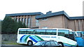
The Seilo Presbyterian Chapel and Theatre
Despite the presence of buses from both banks of the Foyle, this is Caernarfon not Craigavon. In Caernarfon Presbyterians go to chapel and Catholics go to church. In Craigavon it is Presbyterians who attend church and Catholics the chapel.
Image: © Eric Jones
Taken: 29 Sep 2007
0.05 miles
2
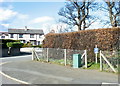
The junction of Ala Las and Ffordd Bethel (B4366)
The blue sign reading 'Dim Golff' indicates that Golf may not be played here.
Image: © Eric Jones
Taken: 20 Mar 2007
0.05 miles
3
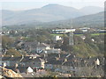
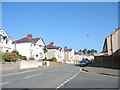
Houses in Hampton and Bethel Road from Twthill
The houses on Hampton and Lower Bethel Road are mostly Edwardian terraced houses with some additional infilling in the inter-war years. The large building behind Bethel Road is the Western Divisional HQ of the Heddlu Gogledd Cymru/North Wales Police.
Image: © Eric Jones
Taken: 24 Oct 2007
0.06 miles
5
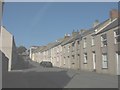
Heol Elinor Street, Twthill
This is a street of Victorian houses.
Image: © Eric Jones
Taken: 24 Oct 2007
0.06 miles
6
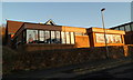
Characters in school windows, Caernarfon
Viewed across Twthill East towards a primary school, Ysgol Santes Helen.
Image: © Jaggery
Taken: 26 Mar 2012
0.07 miles
7
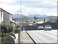
The town end of Ffordd Bethel
Below what once was called Gipsy Hill the Bethel Road reaches a roundabout where it joins the Llanberis-Tanrallt road. The mountains in the background are Yr Eifl.
Image: © Eric Jones
Taken: 20 Mar 2007
0.07 miles
8
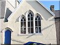
Dennis the Menace and Friends stare out of the windows of the old Catholic Church
With the transference of services from St Helen's Church to the former Anglican St David Church (now called St David and St Helen), at the other end of Twthill Image, the building has been adapted for the purposes of Y Cylch Meithrin - the Nursery Circle - which caters for youngsters below the age of 3.
http://www.jedisparadise.co.uk/childrenstv/Dennis%20and%20Gnasher/Dennis%20and%20Gnasher.htm
Image: © Eric Jones
Taken: 15 Oct 2006
0.08 miles
9
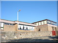
Ysgol Gatholig Santes Helen, Caernarfon
Ysgol Gatholig Santes Helen has the distinction of being the world's only Welsh language-medium Roman Catholic school.
Image: © Eric Jones
Taken: 15 Oct 2006
0.08 miles