
IMAGES TAKEN NEAR TO
Sydney Road, CAERNARFON, LL55 1ET
Introduction
This page details the photographs taken nearby to Sydney Road, LL55 1ET by members of the Geograph project.
The Geograph project started in 2005 with the aim of publishing, organising and preserving representative images for every square kilometre of Great Britain, Ireland and the Isle of Man.

There are currently over 7.5m images from over14,400 individuals and you can help contribute to the project by visiting https://www.geograph.org.uk
Image Map
Images are licensed for reuse under creativecommons.org/licenses/by-sa/2.0
Notes
- Clicking on the map will re-center to the selected point.
- The higher the marker number, the further away the image location is from the centre of the postcode.
Image Listing (202 Images Found)
Images are licensed for reuse under creativecommons.org/licenses/by-sa/2.0
Image
Details
Distance
1
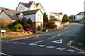
Sidney Road, Caernarfon
Sidney Road climbs away from Warfield Road towards Ael-y-Garth.
Some maps show Sydney Road. The street name sign shows Sidney in both the Welsh and English names.
Image: © Jaggery
Taken: 25 Mar 2012
0.03 miles
2
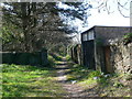
Footpath behind the houses on St David's Road
The path has the back entrances to these houses, and emerges on Sidney Road
Image: © Eirian Evans
Taken: 23 Apr 2008
0.04 miles
3
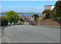
Sidney Road, Caernarfon
The Menai Straits can be seen in the distance with Anglesey on the horizon.
Image: © Eirian Evans
Taken: 23 Apr 2008
0.04 miles
4
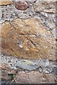
Benchmark on Y Clogwyn, Caernarfon
This worn benchmark is located on the SE side of Y Clogwyn (England Road South) in Caernarfon. The mark is not shown in the current Ordnance Survey database but is shown on an 1888-1889 map of the area as being 132.4ft above the Liverpool datum.
Image: © Meirion
Taken: 15 Sep 2010
0.04 miles
5
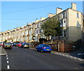
Long row of houses, St David's Road, Caernarfon
Viewed from opposite Rowlands Street. http://www.geograph.org.uk/photo/3719440
Image: © Jaggery
Taken: 25 Mar 2012
0.05 miles
6
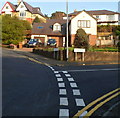
Corner of Sidney Road and Warfield Road, Caernarfon
Warfield Road on the left, Sidney Road on the right.
Some maps show Sydney Road. The street name sign shows Sidney in both the Welsh and English names.
Image: © Jaggery
Taken: 25 Mar 2012
0.05 miles
7
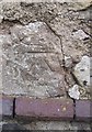
Benchmark on St David's Road, Caernarfon
This benchmark is located on St David's Road (Lôn Ddewi) in Caernarfon. The mark is not shown in the current Ordnance Survey database but is shown on an 1888-1889 map of the area as being 84.0ft above the Liverpool datum.
Image: © Meirion
Taken: 15 Sep 2010
0.06 miles
8
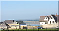
Y Clogwyn - also known as England Road
Y Clogwyn means 'the cliff'. The Menai Strait can be seen in the background.
Image: © Eric Jones
Taken: 15 Oct 2006
0.07 miles
9
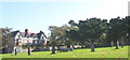
The Gorsedd Stones in Priestly Road
These stones are not ancient. They were erected here in 1959 for the use of the Druids of the Gorsedd of Bards of the Isle of Britain (Gorsedd Beirdd Ynys Prydain) when the National Eisteddfod of Wales visited the town. The Gorsedd is not a pagan religious cult. It includes amongst its members senior Anglican and Catholic bishops, including the present Archbishop of Canterbury.
Image: © Eric Jones
Taken: 15 Oct 2006
0.07 miles
10
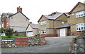
Maes y Bwthyn
These houses are part of a small estate built on the site of the old Caernarfon Cottage Hospital. Maes y Bwthyn means 'cottage field'. The garage of the end house is the old hospital's mortuary.
Image: © Eric Jones
Taken: 22 Nov 2006
0.07 miles