
IMAGES TAKEN NEAR TO
Bethel, CAERNARFON, LL55 1AZ
Introduction
This page details the photographs taken nearby to LL55 1AZ by members of the Geograph project.
The Geograph project started in 2005 with the aim of publishing, organising and preserving representative images for every square kilometre of Great Britain, Ireland and the Isle of Man.

There are currently over 7.5m images from over14,400 individuals and you can help contribute to the project by visiting https://www.geograph.org.uk
Image Map
Images are licensed for reuse under creativecommons.org/licenses/by-sa/2.0
Notes
- Clicking on the map will re-center to the selected point.
- The higher the marker number, the further away the image location is from the centre of the postcode.
Image Listing (13 Images Found)
Images are licensed for reuse under creativecommons.org/licenses/by-sa/2.0
Image
Details
Distance
1
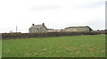
Cefn Gwyn Farm
When sold at the dissolution of the Faenol Estate in 1967, this farm consisted of 64 acres, 25 of which were arable, 20 permanent pasture and 18 rough grazing. The annual rent in 1967 was £205.
Image: © Eric Jones
Taken: 10 Mar 2007
0.00 miles
2
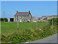
Cefn Gwyn
A breeder of Welsh Mountain Ponies.
Image: © John M
Taken: 10 Jul 2013
0.01 miles
3
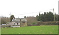
Looking back to the former level crossing at Cefn Gwyn
Image: © Eric Jones
Taken: 10 Mar 2007
0.05 miles
4
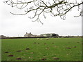
The line of the Dinorwig Quarry railway trackbed across one of the fields of Cefn Gwyn Farm
The trackbed is the slightly elevated bank beyond the three sheep. In the past it would have been bordered on each side by a slate fence.
Image: © Eric Jones
Taken: 10 Mar 2007
0.11 miles
5
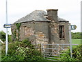
Old Level Crossing Keeper's Box
Situated at the T-junction near Cefn Gwyn, where the Dinorwig Quarry line crossed the minor road between Llanddeiniolen and Y Felinheli, this box was built as shelter for the level crossing keeper.The line was still working into the early 1960s.
Image: © Eric Jones
Taken: 17 May 2006
0.11 miles
6
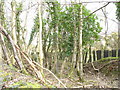
The track of the old Dinorwig Quarry railway line approaching Cefn Gwyn crossing
Image: © Eric Jones
Taken: 10 Mar 2007
0.12 miles
7
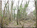
The former Dinorwig Quarry railway track at Gwyndy
Image: © Eric Jones
Taken: 10 Mar 2007
0.15 miles
8
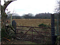
Field near the Greenwood centre
View of a field on the road between the Gors Bach public house and the greenwood centre
Image: © Nigel Williams
Taken: 4 Feb 2006
0.17 miles
9
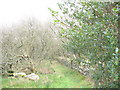
Well engineered path linking Saron village with Cefn Gwyn crossing
Quarrymen from the Saron district used this path to get to and from the quarry train which stopped at Cefn Gwyn Crossing 5 minutes after leaving the terminus at Penscoins. Of the 1131 passengers in 1900, 196 boarded from Cefn Gwyn and Penscoins. They were charged 2s 6d per month, compared with 2s 3d for Bethel passengers, 1s 10d for Llanrug passengers and 1s 3d for the Brynrefail men. Fares were paid in advance on the first Tuesday following the monthly bonus payment. The journey of 7 miles, with five stops and four additional carriage coupling, took 44 minutes. The train was commanded by a train foreman who collected the fares and kept order. For this he was paid 7s 6d per month. Any damage to the train or a late arrival saw a deduction in his pay. The passengers took turns in manually shunting the additional carriages. Anyone caught using bad language or brawling had their monthly ticket withdrawn.
Image: © Eric Jones
Taken: 10 Mar 2007
0.18 miles
10
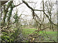
The lower part of the Cefn Gwyn path
The path here is a causeway through a mire. A steel rope and pillar fence, the remains of which can be seen in the middleground, protected the workers during their pre-dawn winter walks to the train.
Image: © Eric Jones
Taken: 10 Mar 2007
0.18 miles