
IMAGES TAKEN NEAR TO
Rhostryfan, CAERNARFON, LL54 7PN
Introduction
This page details the photographs taken nearby to LL54 7PN by members of the Geograph project.
The Geograph project started in 2005 with the aim of publishing, organising and preserving representative images for every square kilometre of Great Britain, Ireland and the Isle of Man.

There are currently over 7.5m images from over14,400 individuals and you can help contribute to the project by visiting https://www.geograph.org.uk
Image Map
Images are licensed for reuse under creativecommons.org/licenses/by-sa/2.0
Notes
- Clicking on the map will re-center to the selected point.
- The higher the marker number, the further away the image location is from the centre of the postcode.
Image Listing (37 Images Found)
Images are licensed for reuse under creativecommons.org/licenses/by-sa/2.0
Image
Details
Distance

2
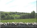
Tyddyn Gwydd Farmhouse from Lon Gwyrfai
This is a view across the Gwyrfai Valley
Image: © Eric Jones
Taken: 3 Jun 2008
0.02 miles
3
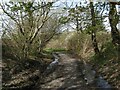
Bryngwyn railway footpath
Wet conditions are still evident (despite a recent lack of rainfall) alongside the footpath which follows the track of the Bryngwyn line towards Tryfan Junction.
Image: © Jonathan Wilkins
Taken: 23 Apr 2021
0.08 miles
4
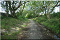
Bryngwyn Branch slate trail nearing Tryfan Junction
This is the former Bryngwyn [narrow gauge railway] branch, which was built to carry slate from the quarries to the coast. The line opened in 1877 and closed in 1937. It is now the Cangen Bryngwyn Branch slate railway trail. You can follow the route of the railway from Tryfan Junction, through Rhostryfan and Bryngwyn to the site of the drumhead at the top of the incline. The trail was created by Cyngor Cymuned Llanwnda / Llanwnda Community Council.
Image: © Christine Johnstone
Taken: 20 Aug 2019
0.09 miles
5
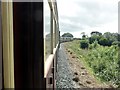
Rhostryfan - 2013
Rhostryfan, Gwynedd, Welsh Highland Railway
Image: © Helmut Zozmann
Taken: 21 Aug 2013
0.11 miles
6
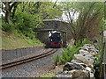
Welsh Highland Line
One of the two Beyer-Garratt loco's used at present on its way from Caernarfon to Beddgelert and soon even further!
Image: © Paul Glover
Taken: 29 May 2010
0.11 miles
7
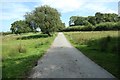
The road to Gwredog Isaf
Mapped as an 'other route with public access'.
Image: © Christine Johnstone
Taken: 20 Aug 2019
0.12 miles
8
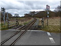
Welsh Highland Railway at Tryfan Junction
The Welsh Highland Railway is a 25-mile long, restored narrow gauge heritage railway in the Snowdonia, operating from Caernarfon to Porthmadog, and passing through a number of popular tourist destinations including Beddgelert and the Aberglaslyn Pass. At Porthmadog it connects with the Ffestiniog Railway and to the short Welsh Highland Heritage Railway. https://en.wikipedia.org/wiki/Welsh_Highland_Railway
Image: © Eirian Evans
Taken: 29 Mar 2018
0.13 miles
9

Tryfan Crossing
The Welsh Highland Railway crosses the road here, it runs from Dinas to Porthmadog.
Image: © Eirian Evans
Taken: 29 Mar 2018
0.13 miles
10
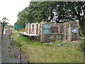
Tryfan Junction, Welsh Highland Railway
Image: © Gareth James
Taken: 7 Sep 2011
0.13 miles