IMAGES TAKEN NEAR TO
Rhosgadfan, CAERNARFON, LL54 7HB
Introduction
This page details the photographs taken nearby to LL54 7HB by members of the Geograph project.
The Geograph project started in 2005 with the aim of publishing, organising and preserving representative images for every square kilometre of Great Britain, Ireland and the Isle of Man.

There are currently over 7.5m images from over14,400 individuals and you can help contribute to the project by visiting https://www.geograph.org.uk
Image Map (Loading...)


Getting Data...Please wait
Leaflet Map data © OpenStreetMap
Images are licensed for reuse under creativecommons.org/licenses/by-sa/2.0
Notes
- Clicking on the map will re-center to the selected point.
- The higher the marker number, the further away the image location is from the centre of the postcode.
Image Listing (19 Images Found)
Images are licensed for reuse under creativecommons.org/licenses/by-sa/2.0
Image
Details
Distance
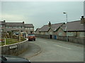
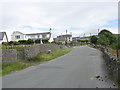
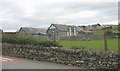
2
The widened road from Tai'r Ffridd to the crossroads by Gwelfor
Image: © Eric Jones
Taken: 15 Jul 2008
0.02 miles
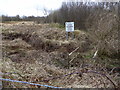
3
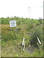
Rhosgadfan Park & Community Wood
An ambitious project for a tiny village - well done to them!
Image: © David Medcalf
Taken: 23 Mar 2006
0.07 miles
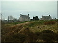
4
Rhosgadfan Community Woodland
Ten years on Image, the community woodland is not looking at its best
Image: © Eirian Evans
Taken: 29 Mar 2018
0.07 miles
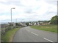
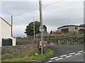
5
Minor road junction in the lower part of Rhosgadfan
The lane on the left leads to Rhosgadfan Cemetery.
Image: © Eric Jones
Taken: 15 Jul 2008
0.07 miles
6
Take your pick - either way you end up in a cemetery
Turn left for Mynwent Rhosgadfan Cemetery, carry straight on for Mynwent Hermon Cemetery.
Image: © Eric Jones
Taken: 15 Jul 2008
0.08 miles
7
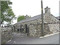
Cae'r Gors - the Kate Roberts Heritage Centre, Rhosgadfan
Kate Roberts (1891-1985) was one of the outstanding Welsh-language novelists and short-story writers of the 20thC. Much of her work was set in the quarrying villages of the first quarter of the century - the period of crippling depression in the slate industry and of the large-scale loss of local lads in WWI
http://www.bbc.co.uk/wales/northwest/halloffame/arts/kateroberts.shtml
http://www.caergors.org/downloads/flyer_hebrew.pdf
http://www.attractionsnorthwales.co.uk/attractions/caer-gors-kate-roberts-heritage-centre
Image: © Eric Jones
Taken: 15 Jul 2008
0.10 miles
8
Mountain Rangers F.C.
At Rhosgadfan. It's a good name for a remote football club.
Image: © David Medcalf
Taken: 23 Mar 2006
0.14 miles
9
Rhosgadfan Park and Community Woodland
This project is a joint creation of the local community and Cydcoed, an agency of the Forestry Commission. The site chosen was an unusable playing field. located on the outskirts of Rhosgadfan. The work has involved planting trees and shrubs, installing of new gates and anti-sheep fences, a bridge and picnic tables. In addition a level playing field has been created, and all for less than 20k.
Image: © Eric Jones
Taken: 15 Jul 2008
0.14 miles
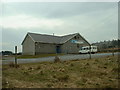
10
Ysgol Gynradd Rhosgadfan Primary School
This a 3-11 community school serving the Rhosgadfan area.
Image: © Eric Jones
Taken: 15 Jul 2008
0.15 miles