
IMAGES TAKEN NEAR TO
Carmel, CAERNARFON, LL54 7AP
Introduction
This page details the photographs taken nearby to LL54 7AP by members of the Geograph project.
The Geograph project started in 2005 with the aim of publishing, organising and preserving representative images for every square kilometre of Great Britain, Ireland and the Isle of Man.

There are currently over 7.5m images from over14,400 individuals and you can help contribute to the project by visiting https://www.geograph.org.uk
Image Map
Images are licensed for reuse under creativecommons.org/licenses/by-sa/2.0
Notes
- Clicking on the map will re-center to the selected point.
- The higher the marker number, the further away the image location is from the centre of the postcode.
Image Listing (17 Images Found)
Images are licensed for reuse under creativecommons.org/licenses/by-sa/2.0
Image
Details
Distance
2
Waymark on the public footpath from Bryngwyn
Not just a waymark, but a stripy post too.
Image: © Christine Johnstone
Taken: 19 Aug 2019
0.05 miles
3
White kissing gate on the public footpath to Bryngwyn
A novel and effective waymark.
Image: © Christine Johnstone
Taken: 19 Aug 2019
0.07 miles
4
Bryngwyn Branch slate trail, near Bryngwyn
The Bryngwyn [narrow gauge railway] branch was built to carry slate from the quarries to the coast. The line opened in 1877 and closed in 1937. It is now the Cangen Bryngwyn Branch slate railway trail. You can follow the route of the railway from Tryfan Junction, through Rhostryfan and Bryngwyn to the site of the drumhead at the top of the incline. The trail was created by Cyngor Cymuned Llanwnda / Llanwnda Community Council.
Image: © Christine Johnstone
Taken: 19 Aug 2019
0.09 miles
5
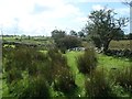
Public footpath heading south-west from Bryngwyn
Heading down the side of the wall to a junction with the path and track to Braich Tri Gwr Mawr. But there is an impassable thicket of bramble at the corner of the field, much easier to divert left to the field entry at the track.
Image: © Christine Johnstone
Taken: 19 Aug 2019
0.11 miles
6
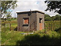
Disused Building, Cae Haidd
I'm not sure of the purpose of this structure, but I would guess it has something to do with water management.
Image: © Chris Andrews
Taken: 6 Aug 2015
0.14 miles
7
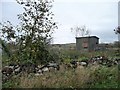
Small building beside the footpath to Cae Haidd Mawr
There are covered reservoirs, disused slate railways and quarries in the vicinity, but not alongside. It looks industrial in origin, but which industry?
Image: © Christine Johnstone
Taken: 17 Nov 2013
0.14 miles
8
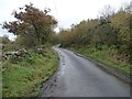
The road up from Low Moor to Paradise
In Welsh, from Rhos Isaf to Bryn Gwynfa [Paradise Hill].
Image: © Christine Johnstone
Taken: 17 Nov 2013
0.14 miles
9
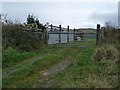
Sheep pen by the public footpath to Cae Haidd Mawr
I assume it's for sheep, certainly for livestock of some kind.
Image: © Christine Johnstone
Taken: 17 Nov 2013
0.15 miles
10
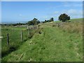
Public footpath crossing the Bryngwyn Branch slate trail
The Bryngwyn [narrow gauge railway] branch was built to carry slate from the quarries to the coast. The line opened in 1877 and closed in 1937. It is now the Cangen Bryngwyn Branch slate railway trail. You can follow the route of the railway from Tryfan Junction, through Rhostryfan and Bryngwyn to the site of the drumhead at the top of the incline. The trail was created by Cyngor Cymuned Llanwnda / Llanwnda Community Council.
Image: © Christine Johnstone
Taken: 19 Aug 2019
0.15 miles