
IMAGES TAKEN NEAR TO
Carmel, CAERNARFON, LL54 7AF
Introduction
This page details the photographs taken nearby to LL54 7AF by members of the Geograph project.
The Geograph project started in 2005 with the aim of publishing, organising and preserving representative images for every square kilometre of Great Britain, Ireland and the Isle of Man.

There are currently over 7.5m images from over14,400 individuals and you can help contribute to the project by visiting https://www.geograph.org.uk
Image Map
Images are licensed for reuse under creativecommons.org/licenses/by-sa/2.0
Notes
- Clicking on the map will re-center to the selected point.
- The higher the marker number, the further away the image location is from the centre of the postcode.
Image Listing (3 Images Found)
Images are licensed for reuse under creativecommons.org/licenses/by-sa/2.0
Image
Details
Distance
1
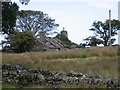
Ruined Cottage at Carmel
Taken from the top of Lon Bron Arfon Lane.
Image: © John S Turner
Taken: 9 Sep 2006
0.11 miles
2
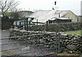
Old Cottage, New Jeep. Pen Bwlch, Carmel.
A view of Pen Bwlch, Carmel. This small tyddyn (croft) lies in its own paddocks, yet surrounded by common land. Its origins were probably a "Tai Un Nos" (one night house) set up by squatters in the C.16 or C.17. The low walls are characteristic of such dwellings that were hastily built in order to claim a piece of common land.
Image: © Stephen Elwyn RODDICK
Taken: 13 Feb 2006
0.17 miles
3
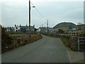
Carmel village
The village is overlooked by old slate tips.
Image: © David Medcalf
Taken: 23 Mar 2006
0.18 miles