
IMAGES TAKEN NEAR TO
County Road, CAERNARFON, LL54 6ES
Introduction
This page details the photographs taken nearby to County Road, LL54 6ES by members of the Geograph project.
The Geograph project started in 2005 with the aim of publishing, organising and preserving representative images for every square kilometre of Great Britain, Ireland and the Isle of Man.

There are currently over 7.5m images from over14,400 individuals and you can help contribute to the project by visiting https://www.geograph.org.uk
Image Map
Images are licensed for reuse under creativecommons.org/licenses/by-sa/2.0
Notes
- Clicking on the map will re-center to the selected point.
- The higher the marker number, the further away the image location is from the centre of the postcode.
Image Listing (76 Images Found)
Images are licensed for reuse under creativecommons.org/licenses/by-sa/2.0
Image
Details
Distance
1
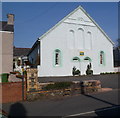
Former Horeb chapel, Penygroes
Opened in 1878 as Capel Horeb (Horeb chapel).
At the March 2012 date of this view, the building had been converted to flats.
Image: © Jaggery
Taken: 24 Mar 2012
0.02 miles
2
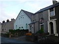
Capel Horeb, Penygroes
Wesleyan Methodist Chapel
Image: © Eirian Evans
Taken: 14 Nov 2008
0.04 miles
3
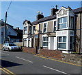
Two houses at the western end of County Road, Penygroes
These two houses are bigger than, and distinctly different from, the dozen
or so houses in the rest of the row leading to the former Capel Horeb. http://www.geograph.org.uk/photo/3461771
Distinctive features include bay windows and ornate designs above the windows.
Image: © Jaggery
Taken: 24 Mar 2012
0.05 miles
4
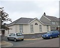
Capel y Groes, Heol Buddug
Capel y Groes (=Chapel of the Cross) was built in 2003
Image: © Eric Jones
Taken: 15 Jul 2008
0.05 miles
5
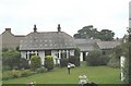
A work of art - a bungalow in Heol Buddug with a decorative slate roof
Contrary to what many think, slate comes in a variety of colours. Many of the colours occurring in the Caernarfonshire Slate Belt are represented on these roofs.
Image: © Eric Jones
Taken: 15 Jul 2008
0.07 miles
6
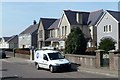
Victoria Road houses, Penygroes
The houses are on the north side of Victoria Road near Capel y Groes http://www.geograph.org.uk/photo/3457852 at the left edge of the view.
Image: © Jaggery
Taken: 24 Mar 2012
0.07 miles
7
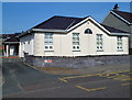
Capel y Groes, Penygroes
The chapel on the north side of Victoria Road dates from 2003.
Image: © Jaggery
Taken: 24 Mar 2012
0.07 miles
9
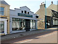
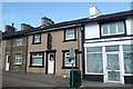
Paragon Funeral Directors, Penygroes
Located on the corner of Water Street and Lôn Pitar.
The Welsh name of the business is in a font twice the size of the English text.
Nearly 90% of the inhabitants of Penygroes speak Welsh, most as their mother tongue.
Image: © Jaggery
Taken: 24 Mar 2012
0.08 miles
10
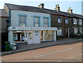
Penygroes Library
Located in Dyffryn Nantlle Technology Centre, Heol y Dŵr (Water Street), Penygroes
part of the Gwynedd Council library service.
Image: © Jaggery
Taken: 24 Mar 2012
0.08 miles