IMAGES TAKEN NEAR TO
Nasareth, CAERNARFON, LL54 6DP
Introduction
This page details the photographs taken nearby to LL54 6DP by members of the Geograph project.
The Geograph project started in 2005 with the aim of publishing, organising and preserving representative images for every square kilometre of Great Britain, Ireland and the Isle of Man.

There are currently over 7.5m images from over14,400 individuals and you can help contribute to the project by visiting https://www.geograph.org.uk
Image Map
Images are licensed for reuse under creativecommons.org/licenses/by-sa/2.0
Notes
- Clicking on the map will re-center to the selected point.
- The higher the marker number, the further away the image location is from the centre of the postcode.
Image Listing (25 Images Found)
Images are licensed for reuse under creativecommons.org/licenses/by-sa/2.0
Image
Details
Distance
1
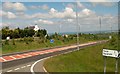
The A487 at the junction with Ffordd y Parc
Ffordd y Parc links the former slate quarrying villages of Nasareth and Nebo with the A487 ( the Fishguard to Bangor Trunk Road).
Image: © Eric Jones
Taken: 14 Jun 2010
0.04 miles
4
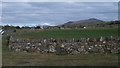
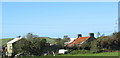
Farmland west of Nasareth
This image was taken from the A487.
Image: © Eric Jones
Taken: 27 Mar 2010
0.07 miles
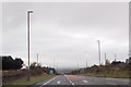
5
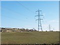
Pylons near Brynychain
Brynychain means "oxenhill".
Image: © Eric Jones
Taken: 9 Mar 2010
0.14 miles
6
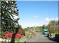
A Mobile Post Office at Nasareth
The flower bedecked white building on the left is Nasareth's post office, but it appears that for some reason it is not currently transacting post office business hence the visit by the mobile post office.
Image: © Eric Jones
Taken: 9 Oct 2006
0.17 miles
7
The road to Graianfryn
Looking south-east from the former railway bridge at Bryn y Gro.
Image: © Christine Johnstone
Taken: 23 Nov 2014
0.18 miles
8
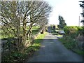
Ffordd Parc, Nasareth
A view west along Ffordd Parc from the corner of Ffordd Cae Duon.
Some maps show Ffordd y Parc, but there is no y in the street name sign.
Image: © Jaggery
Taken: 24 Mar 2012
0.19 miles
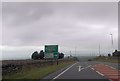
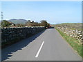
10
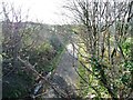
The former Caernarfon - Pwllheli railway line
Now part of Lon Las Cymru, a Sustrans route linking Holyhead and the Wye Valley.
Image: © Christine Johnstone
Taken: 23 Nov 2014
0.22 miles