
IMAGES TAKEN NEAR TO
Llanllyfni, CAERNARFON, LL54 6DL
Introduction
This page details the photographs taken nearby to LL54 6DL by members of the Geograph project.
The Geograph project started in 2005 with the aim of publishing, organising and preserving representative images for every square kilometre of Great Britain, Ireland and the Isle of Man.

There are currently over 7.5m images from over14,400 individuals and you can help contribute to the project by visiting https://www.geograph.org.uk
Image Map
Images are licensed for reuse under creativecommons.org/licenses/by-sa/2.0
Notes
- Clicking on the map will re-center to the selected point.
- The higher the marker number, the further away the image location is from the centre of the postcode.
Image Listing (20 Images Found)
Images are licensed for reuse under creativecommons.org/licenses/by-sa/2.0
Image
Details
Distance
1
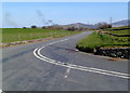
Bend in the road from Nebo to Llanllyfni
The location is rural Gwynedd.
Image: © Jaggery
Taken: 24 Mar 2012
0.02 miles
2
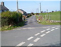
Lane to the A487 south of Llanllyfni
The lane passes Fron-deg and Efail y Berth.
Image: © Jaggery
Taken: 24 Mar 2012
0.02 miles
3

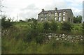
Residential view
Houses overlooking the A487 near Llanllyfni.
Image: © J Scott
Taken: 30 Nov 2010
0.03 miles
5
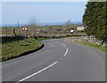
Bend in the road south of Llanllyfni
A view north along the road from Nasareth to Llanllyfni in rural Gwynedd.
Image: © Jaggery
Taken: 24 Mar 2012
0.04 miles
6
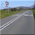
Slow - bends ahead for ? mile south of Llanllyfni
A view north along an unclassifieid road towards Llanllyfni.
Image: © Jaggery
Taken: 24 Mar 2012
0.06 miles
7
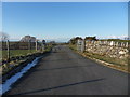
Tarmac Route
Farm access off the A487, near Llanllyfni.
Image: © J Scott
Taken: 28 Nov 2010
0.09 miles
8
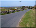
Road north to Llanllyfni
Viewed from the corner of Ffordd Penchwarel. http://www.geograph.org.uk/photo/3452518
Llanllyfni is a kilometre away.
Image: © Jaggery
Taken: 24 Mar 2012
0.09 miles
9
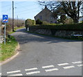
Road junction north of Nasareth
The street name sign on the right shows FFORDD PENCHWAREL.
The sign on the left is one of several in this area telling drivers
of heavy goods vehicles to ignore their satnav and find another route.
Image: © Jaggery
Taken: 24 Mar 2012
0.16 miles
10
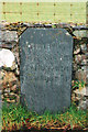
Old Milestone by the former A487, south of Llanllyfni
Carnarvon champhered slate by the UC road, was (A487), in parish of Llanllyfni (Gwynedd District), Nasareth; South of where the new road starts and wall ends, set in stone wall.
Inscription reads:-
........MILES
CARNARVON 8
PENYGROES 1⅝
LLANLLYFNI 1
TREMADOC 11
Grade II listed by Cadw.
Reference Number: 23711 https://cadwpublic-api.azurewebsites.net/reports/listedbuilding/FullReport?lang=&id=23711
Surveyed
Milestone Society National ID: CAE_CVTM08
Image: © Milestone Society
Taken: Unknown
0.18 miles