IMAGES TAKEN NEAR TO
Llandwrog, CAERNARFON, LL54 5TN
Introduction
This page details the photographs taken nearby to LL54 5TN by members of the Geograph project.
The Geograph project started in 2005 with the aim of publishing, organising and preserving representative images for every square kilometre of Great Britain, Ireland and the Isle of Man.

There are currently over 7.5m images from over14,400 individuals and you can help contribute to the project by visiting https://www.geograph.org.uk
Image Map
Images are licensed for reuse under creativecommons.org/licenses/by-sa/2.0
Notes
- Clicking on the map will re-center to the selected point.
- The higher the marker number, the further away the image location is from the centre of the postcode.
Image Listing (9 Images Found)
Images are licensed for reuse under creativecommons.org/licenses/by-sa/2.0
Image
Details
Distance
2
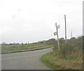
Road Junction on Llandwrog-Dinas Dinlle Road
Image: © Eric Jones
Taken: 6 Oct 2006
0.09 miles
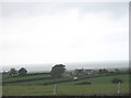
3
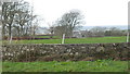
View across the fields towards Pen-y-Bythod
Image: © Eric Jones
Taken: 1 Dec 2007
0.12 miles
5
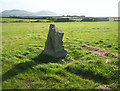
Bodfan Standing Stone
A little out of the way gem.
Image: © Michael Murray
Taken: 22 Dec 2008
0.12 miles
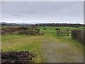
8
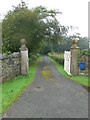
Farm track to Bodfan Farm, near Llandwrog
Image: © Eirian Evans
Taken: 17 Aug 2012
0.15 miles
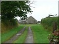
9
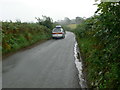
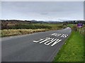
Minor road from the A499 to Dinas Dinlle
Image: © Eirian Evans
Taken: 17 Aug 2012
0.17 miles